
Mount Vesuvius
| Mount Vesuvius | |
|---|---|
| Highest point | |
| Elevation | 1,281 m (4,203 ft) |
| Prominence | 1,232 m (4,042 ft) |
Mount Vesuvius (in Italian Monte Vesuvio and in Latin Mons Vesuvius) is an active stratovolcano east of Naples, Italy. It is the only volcano on the European mainland to have erupted within the last hundred years, although it is not currently erupting. The two other volcanoes in Italy, (Etna and Stromboli) are located on islands.
Mount Vesuvius is on the coast of the Bay of Naples, about nine kilometres (six miles) east of Naples and a short distance from the shore. It is conspicuous in the beautiful landscape presented by that bay, when seen from the sea, with Naples in the foreground. Mount Vesuvius is best known for its eruption in AD 79 that led to the destruction of the Roman cities of Pompeii and Herculaneum. It has erupted many times since and is today regarded as one of the most dangerous volcanoes in the world because of the population of 3,000,000 people now living close to it and its tendency towards explosive eruptions. It is the most densely populated volcanic region in the world.
Mount Vesuvius was regarded by the Greeks and Romans as being sacred to the hero and demigod Heracles/Hercules and the town of Herculaneum, built at its base, was named after him.
Origin of the name
Some of the theories about the origin of the name Vesuvius include:
- Heracles was a son of the Greek god Zeus and the queen Alcmene of Thebes. Zeus was also known as Huēs (Ὓης) in his aspect as the god of rains and dews. Heracles was thus alternatively known as Huēsou huios (Ὓησου υἱός), "Son of Hues." Transliterating the "ου" as "V" (as is normally done), and the other upsilons (with rough breathing) also by V (rather than the usual "HY") and changing to the Latin nominative ending "us", gives VESVVIVS – Vesuvius.
- From the Oscan word festf which means "smoke".
- From the Proto-Indo-European root ves- = "hearth"[citation needed]
Physical appearance

Vesuvius is a distinctive "humpbacked" mountain, consisting of a large cone (Gran Cono) partially encircled by the steep rim of a summit caldera caused by the collapse of an earlier and originally much higher[1] structure called Monte Somma. The Gran Cono was produced during the eruption of 79. For this reason, the volcano is also called Somma-Vesuvius or Somma-Vesuvio.
The caldera started forming during an eruption around 17,000 (or 18,300[2]) years ago[3][4] and was enlarged by later paroxysmal eruptions[5] ending in the one of 79. This structure has given its name to the term "somma volcano", which describes any volcano with a summit caldera surrounding a newer cone.[6]
The height of the main cone has been constantly changed by eruptions but presently is 1,281 m (4,202 ft). Monte Somma is 1,149 m (3,770 ft) high, separated from the main cone by the valley of Atrio di Cavallo, which is some 3 miles (5 km) long. The slopes of the mountain are scarred by lava flows but are heavily vegetated, with scrub at higher altitudes and vineyards lower down. Vesuvius is still regarded as an active volcano, although its current activity produces little more than steam from vents at the bottom of the crater. Vesuvius is a stratovolcano at the convergent boundary where the African Plate is being subducted beneath the Eurasian Plate. Its lava is composed of viscous andesite. Layers of lava, scoria, volcanic ash, and pumice make up the mountain.
Formation

Vesuvius was formed as a result of the collision of two tectonic plates, the African and the Eurasian. The former was pushed beneath the latter, deeper into the earth. The crust material became heated until it melted, forming magma, a type of liquid rock. Because magma is less dense than the solid rock around it, it was pushed upward. Finding a weak place at the Earth's surface it broke through, producing the volcano.
The volcano is one of several which form the Campanian volcanic arc. Others include Campi Flegrei, a large caldera a few kilometres to the north west, Mount Epomeo, 20 kilometres (12 mi) to the west on the island of Ischia, and several undersea volcanoes to the south. The arc forms the southern end of a larger chain of volcanoes produced by the subduction process described above, which extends northwest along the length of Italy as far as Monte Amiata in Southern Tuscany. Vesuvius is the only one to have erupted within recent history, although some of the others have erupted within the last few hundred years. Many are either extinct or have not erupted for tens of thousands of years.
Eruptions

Mount Vesuvius has erupted many times. The famous eruption in 79 AD was preceded by numerous others in prehistory, including at least three significantly larger ones, the best known being the Avellino eruption around 1800 BC which engulfed several Bronze Age settlements. Since 79, the volcano has also erupted repeatedly, in 172, 203, 222, possibly 303, 379, 472, 512, 536, 685, 787, around 860, around 900, 968, 991, 999, 1006, 1037, 1049, around 1073, 1139, 1150, and there may have been eruptions in 1270, 1347, and 1500.[5] The volcano erupted again in 1631, six times in the 18th century, eight times in the 19th century (notably in 1872), and in 1906, 1929, and 1944. There has been no eruption since 1944, and none of the post-79 eruptions were as large or destructive.
The eruptions vary greatly in severity but are characterized by explosive outbursts of the kind dubbed Plinian after Pliny the Younger, the Roman writer who observed the 79 eruption, during which his uncle, the naturalist Pliny the Elder, watched with him. However, Pliny the Elder died when his boat was trapped at a port when the pumice that was floating in the water pushed his boat and stranded it on the beach. On occasion, the eruptions have been so large that the whole of southern Europe has been blanketed by ash; in 472 and 1631, Vesuvian ash fell on Constantinople (Istanbul), over 1,200 kilometres (750 mi) away. A few times since 1944, landslides in the crater raised clouds of ash dust, which caused false alarms of an eruption.
Before 79
The mountain started forming 25,000 years ago. Although the area has been subject to volcanic activity for at least 400,000 years, the lowest layer of eruption material from the Somma mountain lies on top of the 34,000 year-old Campanian Ignimbrite produced by the Campi Flegrei complex, and was the product of the Cordola plinian eruption 25,000 years ago.[7]
It was then built up by a series of lava flows, with some smaller explosive eruptions interspersed between them. However, the style of eruption changed around 19,000 years ago to a sequence of large explosive plinian eruptions, of which the 79 one was the last. The eruptions are named after the tephra deposits produced by them:[1][8]
- The Basal Pumice (Pomici di Base) eruption, 18,300 years ago, VEI 6, was probably the most violent of these eruptions and saw the original formation of the Somma caldera. The eruption was followed by a period of much less violent, lava producing eruptions.
- The Green Pumice (Pomici Verdoline) eruption, 16,000 years ago, VEI 5.
- The Mercato eruption also known as Pomici Gemelle or Ottaviano 8,000 years ago, VEI 6, followed a smaller explosive eruption around 11,000 years ago (called the Lagno Amendolare eruption).
- The Avellino eruption (Pomici di Avellino), 1660 BC ± 43 years, VEI 6, followed two smaller explosive eruptions around 5,000 years ago. The Avellino eruption vent was apparently 2 km west of the current crater, and the eruption destroyed several Bronze Age settlements. The remarkably well-preserved remains of one were discovered in May 2001 near Nola by Italian archaeologists, with huts, pots, livestock and even the footprints of animals and people, as well as skeletons. The residents had hastily abandoned the village, leaving it to be buried under pumice and ash in much the same way that Pompeii was later preserved.[9][10] The eruption was larger than the ones of 79 (VEI 5) and 1631 (VEI 4) with pyroclastic surge deposits distributed to the northwest of the vent, the surges travelling as far as 15 km from it, and lie up to 3 m deep in the area now occupied by Naples.[11]
The volcano then entered a stage of more frequent, but less violent, eruptions until the most recent plinian eruption which destroyed Pompeii.
The last of these may have been in 217 BC.[5] There were earthquakes in Italy during that year and the sun was reported as being dimmed by a haze or dry fog. Plutarch wrote of the sky being on fire near Naples and Silius Italicus mentioned in his epic poem Punica[12] that Vesuvius had thundered and produced flames worthy of Mount Etna in that year, although both authors were writing around 250 years later. Greenland ice core samples of around that period show relatively high acidity, which is assumed to have been caused by atmospheric hydrogen sulfide.[13]
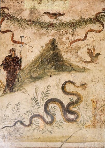
The mountain was then quiet for hundreds of years and was described by Roman writers as having been covered with gardens and vineyards, except at the top which was craggy. Within a large circle of nearly perpendicular cliffs was a flat space large enough for the encampment of the army of the rebel gladiator Spartacus in 73 BC. This area was doubtless a crater. The mountain may have had only one summit at that time, judging by a wall painting, "Bacchus and Vesuvius", found in a Pompeiian house, the House of the Centenary (Casa del Centenario).
Several surviving works written over the 200 years preceding the 79 eruption describe the mountain as having had a volcanic nature, although Pliny the Elder did not depict the mountain in this way in his Naturalis Historia:[14]
- The Greek historian Strabo (ca 63 BC–AD 24) described the mountain in Book V, Chapter 4 of his Geographica[15] as having a predominantly flat, barren summit covered with sooty, ash-coloured rocks and suggested that it might once have had "craters of fire". He also perceptively suggested that the fertility of the surrounding slopes may be due to volcanic activity, as at Mount Etna.
- In Book II of De Architectura,[16] the architect Vitruvius (ca 80-70 BC -?) reported that fires had once existed abundantly below the mountain and that it had spouted fire onto the surrounding fields. He went on to describe Pompeiian Pumice as having been burnt from another species of stone.
- Diodorus Siculus (ca 90 BC–ca 30 BC), another Greek writer, wrote in Book IV of his Bibliotheca Historica that the Campanian plain was called fiery (Phlegrean) because of the mountain, Vesuvius, which had spouted flame like Etna and showed signs of the fire that had burnt in ancient history.[8]
By 79 the area was, as now, densely populated with villages, towns and small cities like Pompeii, and its slopes were covered in vineyards and farms.
Eruption of 79
By the 1st century, Pompeii was only one of a number of towns located around the base of Mount Vesuvius. The area had a substantial population which grew prosperous from the region's renowned agricultural fertility. Many of Pompeii's neighboring communities, most famously Herculaneum, also suffered damage or destruction during the 79 eruption. The 79 eruption, which is thought to have lasted about 19 hours, released about 1 cubic mile (4 cubic kilometres) of ash and rock over a wide area to the south and south-east of the crater, with about 3 m (10 ft) of tephra falling on Pompeii. The white ash produced by this eruption is mainly of leucite and phonolite.
Foreshocks

The 79 eruption was preceded by a powerful earthquake seventeen years beforehand on 5 February, 62,[17] which caused widespread destruction around the Bay of Naples, and particularly to Pompeii. Some of the damage had still not been repaired when the volcano erupted.[18] However, this may have been a tectonic event rather than one associated with the re-awakening of the volcano.[19]
Another smaller earthquake took place in 64 AD; it was recorded by Suetonius in his biography of Nero,[20] in De Vita Caesarum, and by Tacitus in Book XV of Annales[21] because it took place whilst Nero was in Naples performing for the first time in a public theatre. Suetonius recorded that the emperor continued singing through the earthquake until he had finished his song, whilst Tacitus wrote that the theatre collapsed shortly after being evacuated.
The Romans grew used to minor earth tremors in the region; the writer Pliny the Younger even wrote that they "were not particularly alarming because they are frequent in Campania". In early August of 79, springs and wells dried up.[22] Small earthquakes started taking place on 20 August, 79[18] becoming more frequent over the next four days, but the warnings were not recognised (it is worth noting the Romans had no word for volcano, and only a hazy concept of other similar mountains like Mount Etna, home of Vulcan), and on the afternoon of 24 August, a catastrophic eruption of the volcano started. The eruption devastated the region, burying Pompeii and other settlements. By coincidence it was the day after Vulcanalia, the festival of the Roman god of fire.[23][24][25][26][27][28]
Nature of the eruption
The eruption of Vesuvius on 24 and 25 August, 79, unfolded in two phases:[29] a Plinian eruption that lasted eighteen to twenty hours and produced a rain of pumice southward of the cone that built up to depths of 2.8 metres (9 ft 2 in) at Pompeii, followed by a pyroclastic flow or nuée ardente in the second, Peléan phase that reached as far as Misenum but was concentrated to the west and northwest. Two pyroclastic flows engulfed Pompeii, burning and asphyxiating the stragglers who had remained behind. Oplontis and Herculaneum received the brunt of the flows and were buried in fine ash and pyroclastic deposits.[30][31][32][33][34]
The Two Plinys
Pliny the Younger
The only surviving reliable eyewitness account of the event was recorded by Pliny the Younger, who was 17 at the time of the eruption,[35] in two letters to the historian Tacitus.[36] Observing it from Misenum (across the bay, approximately 35 km from the volcano) whilst his uncle sailed closer, he saw an extraordinarily dense and rapidly-rising cloud appearing above the mountain:
I cannot give you a more exact description of its appearance than by comparing to a pine tree; for it shot up to a great height in the form of a tall trunk, which spread out at the top as though into branches. ... Occasionally it was brighter, occasionally darker and spotted, as it was either more or less filled with earth and cinders. (Sixth Book of Letters, Letter 16.)
This was the eruption column, now estimated to have been more than 32 km (20 miles) tall.
After some time he described the cloud rushing down the flanks of the mountain and covering everything around it, including the surrounding sea. This is known today as a pyroclastic flow, which is a cloud of superheated gas, ash, and rock that erupts from a volcano. Geologists have used the magnetic characteristics of over 200 volcanic rocks and pieces of debris (e.g. roof tiles) found in Pompeii to estimate the temperature of this pyroclastic flow. (When molten rock solidifies, magnetic minerals in the rock record the direction of Earth's magnetic field. If the material is heated above a certain temperature, known as the Curie temperature, the rock's magnetic field may be modified or completely reset.) Most of the materials analyzed experienced temperatures between 240 °C and 340 °C (with a few areas showing lower temperatures of only 180 °C). This suggests that the ash cloud had a temperature of 850 °C when emerging from the mouth of Vesuvius and had cooled to below 350 °C by the time it reached the city. It is theorized that turbulence may have mixed cool air into the ash cloud. (Cioni, et al., 2004). This is now called the Plinian stage of the eruption, named after both the younger and elder Plinys.
Pliny stated that several earth tremors were felt at the time of the eruption and were followed by a very violent shaking of the ground. He also noted that ash was falling in very thick sheets and the village he was in had to be evacuated, and then that the sun was blocked out by the eruption and the daylight hours were left in darkness. Also, the sea was sucked away and forced back by an "earthquake", a phenomenon now called a tsunami.
Pliny the Elder
Pliny’s uncle Pliny the Elder was in command of the Roman fleet at Misenum, and had meanwhile decided to take several ships to investigate the phenomenon at close hand. The fleet also attempted a rescue mission for those at the foot of the volcano when, as the ship was preparing to leave the area, a messenger arrived from a friend of Pliny’s living on the coast near the foot of the volcano imploring him to rescue her. He set off across the bay but encountered thick showers of hot cinders, lumps of pumice and pieces of rock which, altering the shoreline and water depths, blocked his approach to the shore and prevented him from landing there. The prevailing southerly wind also stopped him landing there, but he continued south under it to Stabiae (about 4.5 km from Pompeii) where he landed and took shelter with Pomponianus, a friend. Pomponianus had already loaded a ship with possessions and was preparing to leave, but the wind was against him.
Pliny and his party saw flames coming from several parts of the mountain (probably pyroclastic flows and surges, which would later destroy Pompeii and Herculaneum). After staying overnight, the party decided to evacuate in spite of the rain of tephra because of the continuing violent conditions threatening to collapse the building. Pliny, Pomponianus and their companions made their way back towards the beach with pillows tied to their heads to protect them from rockfall. By this time, there was so much ash in the air that the party could barely see through the murk and needed torches and lanterns to find their way. They made it to the beach but found the waters too violently disturbed from the continuous earthquakes for them to escape safely by sea.
Pliny the Elder collapsed and died, and in the first letter to Tacitus his nephew suggested that this was due to the inhalation of poisonous, sulphuric gases. However, Stabiae was 16 km from the vent (roughly where the modern town of Castellammare di Stabia is situated) and his companions were apparently unaffected by the fumes, and so it is more likely that the corpulent Pliny died from some other cause, such as a stroke or heart attack.[37][38] His body was found with no apparent injuries on 26 August, after the plume had dispersed sufficiently for daylight to return.
Casualties from the eruption

Along with Pliny the Elder, the only other noble casualties of the eruption to be known by name were Agrippa (a son of the Jewish princess Drusilla and the procurator Antonius Felix) and his wife.[39]
Estimates of the population of Pompeii range from 10,000[40] to 25,000,[28] and Herculaneum is thought to have had a population of about 5,000.[41] It is not known how many people the eruption killed, although around 1,150 remains of bodies – or casts made of their impressions in the ash deposits – have been recovered in and around Pompeii.[42] The remains of about 350 bodies have been found at Herculaneum (300 in arched vaults discovered in 1980).[43] However these figures must represent a great underestimation of the total number of deaths over the region affected by the eruption.
Thirty-eight percent of the victims at Pompeii were found in the ash fall deposits, the majority inside buildings. These are thought to have been killed mainly by roof collapses, with the smaller number of victims found outside of buildings probably being killed by falling roof slates or by larger rocks thrown out by the volcano. This differs from modern experience, since over the last four hundred years only around 4% of victims have been killed by ash falls during explosive eruptions. The remaining 62% of remains found at Pompeii were in the pyroclastic surge deposits,[42] and thus were probably killed by them – probably from a combination of suffocation through ash inhalation and blast and debris thrown around. In contrast to the victims found at Herculaneum, examination of cloth, frescoes and skeletons show that it is unlikely that high temperatures were a significant cause.
Herculaneum, which was much closer to the crater, was saved from tephra falls by the wind direction, but was buried under 23 metres (75 ft) of material deposited by pyroclastic surges. It is likely that most, or all, of the victims in this town were killed by the surges, particularly given evidence of high temperatures found on the skeletons of the victims found in the arched vaults, and the existence of carbonised wood in many of the buildings.
Pompeii and Herculaneum were never rebuilt, although surviving townspeople and probably looters did undertake extensive salvage work after the destructions. The eruption changed the course of the Sarno River and raised the sea beach, so that Pompeii was now neither on the river nor adjacent to the coast.
The towns' locations were eventually forgotten until their accidental rediscovery in the 18th century. Vesuvius itself underwent major changes – its slopes were denuded of vegetation and its summit had changed considerably due to the force of the eruption.[44][45][46][47][48][49][50][51][52]
Date of the eruption
The eruption of AD 79 was documented by contemporary historians and is universally accepted as having started on August 24th. However the archeological excavations of Pompeii suggest that the town was buried a couple of months later.[53][54] For example, people buried in the ash appear to be wearing warmer clothing than the light summer clothes that would be expected in August. The fresh fruit and vegetables in the shops are typical of October, and conversely the summer fruit that would have been typical of August was already being sold in dried, or conserved form. Wine fermenting jars had been sealed over, and this would have happened around the end of October. The coins found in the purse of a woman buried in the Ash include a commemorative coin that should have been minted at the end of September. So far there is no definitive theory as to why there should be such an apparent discrepancy.
Later eruptions from the 3rd to the 19th century

Since the eruption of 79, Vesuvius has erupted around three dozen times. It erupted again in 203, during the lifetime of the historian Cassius Dio. In 472, it ejected such a volume of ash that ashfalls were reported as far away as Constantinople. The eruptions of 512 were so severe that those inhabiting the slopes of Vesuvius were granted exemption from taxes by Theodoric the Great, the Gothic king of Italy. Further eruptions were recorded in 787, 968, 991, 999, 1007 and 1036 with the first recorded lava flows. The volcano became quiescent at the end of the 13th century and in the following years it again became covered with gardens and vineyards as of old. Even the inside of the crater was filled with shrubbery.
Vesuvius entered a new and particularly destructive phase in December 1631, when a major eruption buried many villages under lava flows, killing around 3,000 people. Torrents of boiling water were also ejected, adding to the devastation. Activity thereafter became almost continuous, with relatively severe eruptions occurring in 1660, 1682, 1694, 1698, 1707, 1737, 1760, 1767, 1779, 1794, 1822, 1834, 1839, 1850, 1855, 1861, 1868, 1872, 1906, 1926, 1929, and 1944.
Eruptions in the 20th century
The eruption of 1906 was particularly destructive, killing over 100 people and ejecting the most lava ever recorded from a Vesuvian eruption. Its last major eruption to date came in March 1944, destroying the villages of San Sebastiano al Vesuvio, Massa di Somma, Ottaviano, and part of San Giorgio a Cremano, as well as all 88 planes in a U.S. B-25 bomber group [55], as World War II continued to rage in Italy.
From January 6, 1944 to February 23, 1944, lava flows appeared within the rim and there were outflows. The activity paused on February 23 and resumed on March 13. Small explosions then occurred until the major explosion took place on March 18, 1944.[56] The eruption could be seen from Naples and several photos have been taken.[57]
The volcano has been quiescent ever since. Over the past few centuries, the quiet stages have varied from 18 months to 7½ years, making the current lull in activity the longest in nearly 500 years. While Vesuvius is not thought likely to erupt in the immediate future, the danger posed by future eruptions is seen as very high in light of the volcano's tendency towards sudden, extremely violent explosions, and the very dense human population on and around the mountain.
The future

Large plinian eruptions which emit magma in quantities of about 1 km³ or more, the most recent of which overwhelmed Pompeii, have happened after periods of inactivity of a few thousand years. Subplinian eruptions producing about 0.1 km³, such as those of 472 and 1631, have been more frequent with a few hundred years between them. Following the 1631 eruption until 1944 every few years saw a comparatively small eruption which emitted 0.001-0.01 km³ of magma. It seems that for Vesuvius the amount of magma expelled in an eruption increases very roughly linearly with the interval since the previous one, and at a rate of around 0.001 km³ for each year. This gives an extremely approximate figure of 0.06 km³ for an eruption after 60 years of inactivity.[58]
Magma sitting in an underground chamber for many years will start to see higher melting point constituents such as olivine crystallising out. The effect is to increase the concentration of dissolved gases (mostly steam and carbon dioxide) in the remaining liquid magma, making the subsequent eruption more violent.[13] As gas-rich magma approaches the surface during an eruption, the huge drop in pressure caused by the reduction in weight of the overlying rock (which drops to zero at the surface) causes the gases to come out of solution, the volume of gas increasing explosively from nothing to perhaps many times that of the accompanying magma. Additionally, the removal of the lower melting point material will raise the concentration of felsic components such as silicates potentially making the magma more viscous, adding to the explosive nature of the eruption.
The emergency plan for an eruption therefore assumes that the worst case will be an eruption of similar size and type to the 1631 VEI 4[59] one. In this scenario the slopes of the mountain, extending out to about 7 kilometres (4.3 miles) from the vent, may be exposed to pyroclastic flows sweeping down them, whilst much of the surrounding area could suffer from tephra falls. Because of prevailing winds, towns to the south and east of the volcano are most at risk from this, and it is assumed that tephra accumulation exceeding 100 kg/m² – at which point people are at risk from collapsing roofs — may extend out as far as Avellino to the east or Salerno to the south east. Towards Naples, to the north west, this tephra fall hazard is assumed to extend barely past the slopes of the volcano.[58] The specific areas actually affected by the ash cloud will depend upon the particular circumstances surrounding the eruption. [60]

The plan assumes between two weeks and 20 days [61][62] notice of an eruption and foresees the emergency evacuation of 600,000 people, almost entirely comprising all those living in the zona rossa ("red zone"), i.e. at greatest risk from pyroclastic flows. The evacuation, by trains, ferries, cars, and buses is planned to take about seven days, and the evacuees will mostly be sent to other parts of the country rather than to safe areas in the local Campania region, and may have to stay away for several months. However the dilemma that would face those implementing the plan is when to start this massive evacuation, since if it is left too late then many people could be killed, whilst if it is started too early then the precursors of the eruption may turn out to have been a false alarm. In 1984, 40,000 people were evacuated from the Campi Flegrei area, another volcanic complex near Naples, but no eruption occurred. [62]
Ongoing efforts are being made to reduce the population living in the red zone, by demolishing illegally constructed buildings, establishing a national park around the upper flanks of the volcano to prevent the erection of further buildings[62] and by offering financial incentives to people for moving away. The underlying goal is to reduce the time needed to evacuate the area, over the next 20 or 30 years, to two or three days.[63]
The volcano is closely monitored by the Osservatorio Vesuvio in Naples with extensive networks of seismic and gravimetric stations, a combination of a GPS-based geodetic array and satellite-based synthetic aperture radar[64] to measure ground movement, and by local surveys and chemical analyses of gases emitted from fumaroles. All of this is intended to track magma rising underneath the volcano. So far, no magma has been detected within 10 km of the surface, and so the volcano was, in 2001, at worst only in the very early stages of preparing for an eruption.[58] This status has apparently not changed much to date.[65][66]

Vesuvius today
The area around Vesuvius was officially declared a national park on 5 June 1995[67]. The summit of Vesuvius is open to visitors and there is a small network of paths around the mountain that are maintained by the park authorities on weekends.
There is access by road to within 200 metres of the summit (measured vertically), but thereafter access is on foot only. There is a spiral walkway around the mountain from the road to the crater.
See also
References
- ^ a b "Summary of the eruptive history of Mt. Vesuvius". Osservatorio Vesuviano, Italian National Institute of Geophysics and Volcanology. Retrieved 2006-12-08. Cite error: The named reference "OS storia" was defined multiple times with different content (see the help page).
- ^ "The Pomici Di Base Eruption". Osservatorio Vesuviano, Italian National Institute of Geophysics and Volcanology. Retrieved 2006-12-08.
- ^ Vesuvius, Italy, Volcano World
- ^ The world's top volcanoes, Scentia
- ^ a b c "Vesuvius". Global Volcanism Program. Smithsonian Institution. Retrieved 2006-12-08. Cite error: The named reference "global volcanism" was defined multiple times with different content (see the help page).
- ^ "Definition of somma volcano". Volcano Live. Retrieved 2006-12-11.
- ^ Garrett, Roger A. (2005). "Vesuvius' next eruption". Geotimes. doi:10.1002/9780470750865. Retrieved 2006-12-08.
{{cite journal}}: Unknown parameter|month=ignored (help) - ^ a b "Somma-Vesuvius". Department of Physics, University of Rome. Retrieved 2006-12-08.
- ^ "An ancient Bronze Age village (3500 bp) destroyed by the pumice eruption in Avellino (Nola-Campania)". Retrieved 2006-12-08.
- ^ "Vesuvius' Next Eruption May Put Metro Naples at Risk - Lesson from Katrina is need to focus on "maximum probable hazard"". State University of New York. Retrieved 2006-12-08.
- ^ "Pomici di Avellino eruption". Osservatorio Vesuviano, Italian National Institute of Geophysics and Volcanology. Retrieved 2006-12-08.
- ^ Stothers, R.B. (2002). "The case for an eruption of Vesuvius in 217 BC (abstract)". Ancient Hist. Bull. 16: 182–185. doi:10.1002/9780470750865.
- ^ a b de Boer, Jelle Zeilinga & Sanders, Donald Theodore (2002). Volcanoes in Human History. Princeton University Press. ISBN 0-691-05081-3.
{{cite book}}: CS1 maint: multiple names: authors list (link) - ^ Pliny the Elder, The Natural History (eds. John Bostock, M.D., F.R.S., H.T. Riley, Esq., B.A.) (translation)
- ^ Strabo: Geography Book V Chapter 4 (translation)
- ^ Marcus Vitruvius Pollio: de Architectura, Book II (translation)
- ^ Patterns of Reconstruction at Pompeii
- ^ a b "Visiting Pompeii - AD 79 - Vesuvius explodes". Current Archeology. Retrieved 2006-12-08.
- ^ "Three Decades of Seismic Activity at Mt. Vesuvius: 1972–2000".
- ^ The Life of Nero, Suetonius, The Lives of the Caesars
- ^ The Annals by Publius Cornelius Tacitus - Book 15
- ^ Pompeii at the State University of Minnesot's E-museum
- ^ Area Vesuvio (in Italian) Retrieved on 18 August 2007
- ^ Account of 1785 eruption by Hester Thrale
- ^ Stromboli Online - Vesuvius & Campi Flegrei
- ^ Visiting Pompeii Retrieved on 18 August 2007
- ^ Wall painting of Vesuvius found in Pompeii
- ^ a b "The Destruction of Pompeii, 79 AD". Eyewitness to History. Retrieved 2006-12-08.
- ^ Haraldur Sigurdsson, Stanford Cashdollar and Stephen R. J. Sparks, "The eruption The Eruption of Vesuvius in A. D. 79: Reconstruction from Historical and Volcanological Evidence" American Journal of Archaeology '86.1 (January 1982), pp. 39-51.
- ^ 52 Minute MP3 Audio Discussion on the Theological significance of AD79
- ^ ERUPT Project - Vesuvius
- ^ Herculaneum: Destruction and Re-discovery
- ^ Live Mount Vesuvius Webcams: from Casalnuovo, from Sorrento
- ^ Official Vesuvius National Park website (in Italian) Retrieved on 18 August 2007
- ^ PLINY THE YOUNGER: ERUPTION OF MT. VESUVIUS, AD 79
- ^ The Destruction of Pompeii, 79 AD, Translation of Pliny's letters. Original.
- ^ Jules Janick, Purdue University (2002). "Greek, Carthaginian, and Roman Agricultural Writers". History of Horticulture. Retrieved 2006-12-08.
- ^ "Derivation of the name "Plinian"". The Volcano Information Center. Retrieved 2006-12-08.
- ^ Mentioned in Josephus, Jewish Antiquities, xx.7.2, and in a lost section of the work.
- ^ Doug Criner. "Engineering of Pompeii". Retrieved 2006-12-08.
- ^ "Vesuvius, Italy". Volcano World. Retrieved 2006-12-08.
- ^ a b Lisetta Giacomelli, Annamaria Perrotta, Roberto Scandone, Claudio Scarpati (2003). "The eruption of Vesuvius of 79 AD and its impact on human environment in Pompei" (PDF). Episodes. 26. doi:10.1002/9780470750865. Retrieved 2006-12-08.
{{cite journal}}: Unknown parameter|month=ignored (help)CS1 maint: multiple names: authors list (link) - ^ "Pompeii, Stories from an eruption". The Field Museum of Natural History, Chicago. Retrieved 2006-12-08.
- ^ Vesuvius National Park brochure (Adobe PDF)
- ^ Vesuvius National Park
- ^ Disaster preparedness page for the US Naval Support Actitivy Naples
- ^ Guardian Newspaper article "Italy ready to pay to clear slopes of volcano"
- ^ Tango Diva article - "Mount Vesuvius, the sleeping giant"
- ^ Explore Italian Volcanoes, at Dipartimento di Fisica "E. Amaldi" Universita' Roma Tre, Italy
- ^ Image of Vesuvius at Volcano World
- ^ Top volcanoes worldwide (i.e. Famous and recent eruptions)
- ^ BBC article discussing potential danger to modern inhabitants.
- ^ Grete Stefani (2006). "La vera data dell'eruzione" ([dead link] – Scholar search). Archeo (260): 10–14. doi:10.1002/9780470750865. Retrieved 2007-12-02.
{{cite journal}}: External link in|format=|month=ignored (help) (in Italian) - ^ Gabi Laske. "The A.D. 79 Eruption at Mt. Vesuvius". Lecture notes for UCSD-ERTH15: "Natural Disasters". Retrieved 2007-07-20.
- ^ Aviation and the effects of Volcano Ash, Federal Aviation Authority
- ^ The eruption of Vesuvius of 1944
- ^ Mt. Vesuvius eruption, as seen from Naples, 1944
- ^ a b c Kilburn, Chris & McGuire, Bill (2001). Italian Volcanoes. Terra Publishing. ISBN 1-903544-04-1.
{{cite book}}: CS1 maint: multiple names: authors list (link) - ^ "Activity of Vesuvio between 1631 and 1799". Explore Italian Volcanoes. Retrieved 2006-12-09.
- ^ "Emergency plan (Italian)". Retrieved 2006-12-09.
- ^ In the shadow of the volcano, UK Guardian newspaper, 16 October 2003
- ^ a b c "Italians trying to prevent a modern Pompeii". USA Today. 21 October 2003. Retrieved 2006-12-08.
- ^ "Early Warning of Volcanic eruptions and Earthquakes in the neapolitan area, Campania Region, South Italy" (pdf). Second International Conference on Early Warning, Bonn, Germany, 16-18 October 2003. Retrieved 2007-01-26.
{{cite conference}}: Unknown parameter|booktitle=ignored (|book-title=suggested) (help); Unknown parameter|coauthors=ignored (|author=suggested) (help) - ^ "ESA press release on satellite monitoring of Vesuvius". Retrieved 2007-01-26.
- ^ "Monitoring of Mount Vesuvius". Osservatorio Vesuviano, Italian National Institute of Geophysics and Volcanology. Retrieved 2006-12-08.
- ^ "Present level of alert on Vesuvius". Osservatorio Vesuviano, Italian National Institute of Geophysics and Volcanology. Retrieved 2006-12-08.
- ^ Vesuvius portal website
External links
 Media related to Vesuvio at Wikimedia Commons