Älplesattel
| Älplesattel | |||
|---|---|---|---|
|
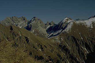
Älpelesattel (the saddle cut wide) from the Kegelkopf |
|||
| Compass direction | west | east | |
| Pass height | 1780 m | ||
| district | District of Oberallgäu | ||
| Watershed | Dietersbach → Trettach → Iller | Schartenbach → Oybach → Trettach | |
| expansion | Hiking trails | ||
| Mountains | Allgäu Alps | ||
| map | |||
|
|
|||
| Coordinates | 47 ° 21 '27 " N , 10 ° 21' 25" E | ||
The Älplesattel (also Älpelesattel or Alpelsattel ) is a 1780 meter high mountain saddle between Oytal and Dietersbachtal near Oberstdorf in the Allgäu Alps . The saddle can be reached from both valleys. The path from the Oytal is partly overgrown, but less steep than the ascent over the Dietersbachtal. The Rauheck and the Höfats can be reached from the Älpelesattel .

