9th arrondissement (Lyon)
|
9th arrondissement Arrondissement municipal of Lyon |
|
|---|---|
| Coordinates | 45 ° 46 ′ 31 ″ N , 4 ° 48 ′ 19 ″ E |
| Residents | 50,687 (Jan. 1, 2017) |
| INSEE code | 69389 |
| Post Code | 69009 |
| structure | |
| Quarters | |
The 9th arrondissement is one of the nine arrondissements (boroughs) of the French city of Lyon . In 2014, 48,824 people lived here.
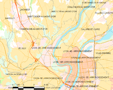
The arrondissement is located in the northwest of the urban area of Lyon. It is bounded to the east by the Saône ; the river island Île Barbe is one of them. In the north it borders on Saint-Didier-au-Mont-d'Or , Saint-Cyr-au-Mont-d'Or and Collonges-au-Mont-d'Or , in the northeast, where the Saône forms the city limits Caluire-et-Cuire , to the east to the 4th and 1st arrondissement , to the south to the 5th arrondissement and to the west to Tassin-la-Demi-Lune and Écully .
history
By decree of August 12, 1964, the northern part was separated from the 5th arrondissement and combined with the municipality of Saint-Rambert-l'Île-Barbe (it was incorporated on August 1, 1963) to form the new 9th arrondissement.
geography
The 9th arrondissement covers an area of 7.25 km².
quarter
It consists of the following districts ( French quarters ):
- Vaise
- Gorge-de-Loup
- La Duchere
- Saint-Rambert-l'Île-Barbe
- Observance
- Industry
- Champvert
- Rochecardon
Buildings
- Église Saint-Pierre de Vaise
- Église Notre-Dame de l'Annonciation
- Église Saint-Camille
- Église Notre-Dame de l' Île Barbe
- Château de la Jayere .
Streets, squares, green spaces
Grande Rue de Vaise , Place Valmy, Place de Paris, Parc du Vallon , Parc de Saint Rambert, Île Barbe.
Demographics
| year | 1999 | 2005 | 2008 | 2009 | 2011 |
|---|---|---|---|---|---|
| Residents | 47.030 | 47,200 | 48,673 | 48,574 | 48,431 |
In 2013 the population density was 6,748 inh / km².
Public facilities
Culture
- Théâtre Nouvelle Génération (TNG), CDN .
- Pathé cinema complex
- Conservatoire national supérieur musique et danse de Lyon (CNSMDL)
Transport links
- Métro Lyon D , stations Gorge de Loup , Valmy , Gare de Vaise


