A3 (Cyprus)
| A3 motorway in Cyprus | |

|
|
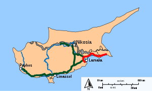
| map | |
| Basic data | |
| Operator: | |
| Start of the street: | Larnaka |
| End of street: | Ayia Napa |
| Overall length: | 55 km |
| of which in operation: | 55 km |
|
( District ): |
|
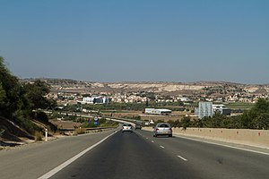
| A3 at Xylotymbou | |
The A3 motorway is a motorway in Cyprus . The highway is a bypass of the city of Larnaca and then runs east through the British military area to Agia Napa . The highway is 55 kilometers long.
Street description
The A3 begins south of Larnaka at the city's airport and then runs in four lanes in an arc around Larnaka. On the west side it crosses the A5 from Limassol and on the north side it crosses the A2 from Nicosia . The motorway then runs east along the coast, through the British territory of Dhekelia, there are no border posts. In Agia Napa the highway ends on the four-lane road from Agia Napa to Deryneia .
history
Most of the motorway was built in the 1990s and 2000s. It took about 10 years to complete the road in five phases. The A3 was the first ring road in Cyprus.
Web links
- Information on Wegenwiki.nl (Dutch)

