Altınözü
| Altınözü | ||||
|
||||

|
||||
| Basic data | ||||
|---|---|---|---|---|
| Province (il) : | Hatay | |||
| Coordinates : | 36 ° 6 ' N , 36 ° 14' E | |||
| Height : | 400 m | |||
| Residents : | 61,341 (2014) | |||
| Telephone code : | (+90) 326 | |||
| Postal code : | 31750 | |||
| License plate : | 31 | |||
| Structure and administration (status: 2009) | ||||
| Mayor : | Rifat Sarı ( AKP ) | |||
| Website: | ||||
| Altınözü County | ||||
| Residents : | 61,341 (2014) | |||
| Surface: | 357 km² | |||
| Population density : | 172 inhabitants per km² | |||
| Kaymakam : | Alp Arslanköylü | |||
| Website (Kaymakam): | ||||
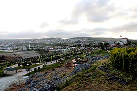
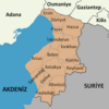
Altınözü ( Arabic القصير) is a Turkish city and district in the Hatay province in the eastern Mediterranean on the Syrian border. The city had 61,341 inhabitants in 2014, the majority of whom are Alawite and Sunni Arabs . Tokaçlı and Sarilarmahallesi are the Christian villages in Altinözü. Since a regional reform in 2014, the district is identical in terms of area and population to the district town.
Agriculture , mainly wheat , tobacco , barley , fruit and vegetables, spices and olive oil production are of economic importance.
Web links
Commons : Altınözü - collection of pictures, videos and audio files
Individual evidence
- ↑ a b Turkish Institute for Statistics ( Memento from December 13, 2015 on WebCite ), accessed December 13, 2015


