Belen (Hatay)
| Belen | ||||
|
||||
| Basic data | ||||
|---|---|---|---|---|
| Province (il) : | Hatay | |||
| Coordinates : | 36 ° 29 ' N , 36 ° 12' E | |||
| Height : | 620 m | |||
| Residents : | 21,936 (2010) | |||
| Telephone code : | (+90) 326 | |||
| Postal code : | 31350 | |||
| License plate : | 31 | |||
| Structure and administration (as of 2011) | ||||
| Mayor : | Adnan Vurucu ( ACP ) | |||
| Belen County | ||||
| Residents : | 28,950 (2010) | |||
| Surface: | 213 km² | |||
| Population density : | 136 inhabitants per km² | |||
| Kaymakam : | Mehmet Öz | |||
| Website (Kaymakam): | ||||
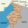
Belen is a district town in the Turkish province of Hatay . Belen is also the capital of the district of the same name . The city has 21,936 and the district 28,950 inhabitants (as of 2010). Belen is located in the southern part of the Amanosberge in a valley gen Mediterranean . The highest point in Belen is the Çobandede at 1722 m.
In 1552 Sultan Suleyman I laid the foundation stone for the first settlement called Tepecik. The place was founded a few kilometers south of İskenderun on the site of the Syrian Gate (also called Beilan Pass ). The gate was an important passage between Cilicia and Syria . Tepecik was supposed to be a stopover on a new route between Aleppo and İskenderun. In the reports of the Ottoman traveler Evliya Çelebi , who stayed here in 1648, the place was already called Belen. The word Belen probably comes from the Greek word for gate ( pylan ). In 1770 more people were settled here and the place was called Beylan. In 1885 the mayor's office was established (tr. Belediye ). The Turkish trunk road D817 ( European route 91 ) leads from İskenderun through the gate to Antakya .
See also
Individual evidence
- ↑ a b Turkish Institute for Statistics ( Memento from December 5, 2012 in the web archive archive.today ), accessed on May 22, 2011


