Ambrolauri
|
Ambrolauri ამბროლაური |
|||
|
|||
| State : |
|
||
| Region : | Ratscha-Letschchumi and Lower Swanetia | ||
| Municipality : | Ambrolauri | ||
| Founded : | 17th century | ||
| Coordinates : | 42 ° 31 ' N , 43 ° 10' E | ||
| Height : | 580 m. ü. M. | ||
| Residents : | 2,047 (2014) | ||
| Time zone : | Georgian Time (UTC + 4) | ||
| Community type: | city | ||
|
|
|||
Ambrolauri ( Georgian ამბროლაური ) is the capital of the Georgian region of Ratscha-Letschchumi and Lower Svaneti and at the same time the administrative center of the municipality of the same name Ambrolauri . It has 2047 inhabitants (2014).
location
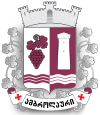
The place is located in the northern central part of Georgia about 160 kilometers as the crow flies northwest of the capital Tbilisi and a good 40 kilometers south of the main ridge of the Greater Caucasus and the border with Russia, mainly on the left bank of the Rioni , into which the Krichula river flows. A few kilometers up the Rionia towards Oni , the valley narrows, while downriver it widens and is used for wine-growing because of its protected climate : This is where the red wine Chwantschkara , which is popular in the successor states of the Soviet Union, is produced, which is also reflected in the design of the city's coat of arms . The eponymous village Chwantschkara is located a good twelve kilometers west (downstream) of Ambrolauri.
history
Located in the historic Ratscha countryside, it has been known since the 17th century when one of the residences of the kings of Imereti was located there. In 1769 the third last Imeretic King Solomon I gave the place to Prince Zurab Matschabeli.
In 1810 Ambrolauri came to Russia and later belonged to the Ujesd Ratscha of the Kutais governorate .
During the Soviet period, the place received the status of an urban-type settlement and in 1966 city rights. On April 29, 1991, Ambrolauri was partially destroyed by the worst earthquake ever recorded in this part of the Caucasus (magnitude 7.0 on the Richter scale ; MSK IX).
- Population development
| year | Residents |
|---|---|
| 1959 | 3043 |
| 1970 | 2317 |
| 1979 | 2639 |
| 1989 | 2933 |
| 2002 | 2531 |
| 2014 | 2047 |
Note: census data
Culture and sights
Church ruins and a tower have been preserved from the Imeretic royal residence. The place has an art museum and a theater.
Economy and Infrastructure
In Ambrolauri there are companies in the food industry (wine, juices, canned food).
There is a road connection to the south towards Tqibuli and on to central Georgia. The road crosses over the 1218 m high Nakerala pass the 1500 to 2000 m high Ratscha Mountains (Georgian Ratschis kedi ). The nearest train station is in Tqibuli, 42 km away by road (25 km as the crow flies). In Ambrolauri, the road crosses the Rioni and there connects to the Ossetian military road that follows the river on its right-hand side from the Russian border via Oni to Kutaisi .
Web links
- Article Ambrolauri in the Great Soviet Encyclopedia (BSE) , 3rd edition 1969–1978 (Russian)
Individual evidence
- ↑ Population Census 2014 ( Memento of the original from September 20, 2016 in the Internet Archive ) Info: The archive link was inserted automatically and has not yet been checked. Please check the original and archive link according to the instructions and then remove this notice.


