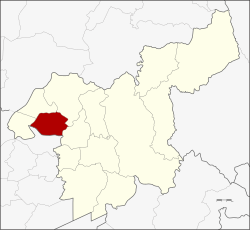
Amphoe Ban Mon.
|
Ban Mo บ้านหมอ |
|
|---|---|
| Province: | Saraburi |
| Surface: | 203.6 km² |
| Residents: | 42,614 (2013) |
| Population density : | 153.3 U / km² |
| ZIP : | 18130, 18210, 18270 |
| Geocode : | 1906 |
| map | |

|
|
Amphoe Ban Mo ( Thai : อำเภอ บ้านหมอ ) is a district ( amphoe - administrative district) in the western part of Saraburi Province . The Saraburi Province is located in the central region of Thailand .
history
After the Buddha's footprint was found at Saraburi and a temple was built over it, King Songtham had Dutch engineers build a road from Tha Ruea to Wat Phra Phutthabat to facilitate pilgrimage there. The main work in this was done by elephants . Sick animals were cured in Wat Khok, a Buddhist temple ( Wat ) . The temple was later renamed Wat Khok Ban Mo and finally Wat Ban Mo, which gave this district its name.
geography
Neighboring districts (clockwise from the west): Amphoe Don Phut , Amphoe Nong Don , Amphoe Phra Phutthabat and Amphoe Sao Hai of the province of Saraburi and Amphoe Tha Ruea of the province of Ayutthaya .
administration
Provincial Administration
The district of Ban Mo is divided into nine tambon ("subdistricts" or "municipalities"), which are further subdivided into 79 muban ("villages").
| No. | Surname | Thai | Muban | Pop. |
|---|---|---|---|---|
| 1. | Ban Mo | บ้านหมอ | 12 | 7,686 |
| 2. | Bang Khamot | บาง โขมด | 11 | 5,876 |
| 3. | Sang Sok | สร่าง โศก | 9 | 6.320 |
| 4th | Talat Noi | ตลาด น้อย | 8th | 4,907 |
| 5. | Horathep | หร เทพ | 8th | 1,523 |
| 6th | Khok Yai | โคก ใหญ่ | 6th | 1,543 |
| 7th | Phai Khwang | ไผ่ ขวาง | 7th | 2,885 |
| 8th. | Ban Khrua | บ้าน ครัว | 11 | 8,273 |
| 9. | Nong Bua | หนองบัว | 7th | 3,601 |
Local administration
There are six municipalities with "small town" status ( Thesaban Tambon ) in the district:
- Bang Khamot (Thai: เทศบาล ตำบล บาง โขมด ) consisting of the complete Tambon Bang Khamot.
- Sang Sok (Thai: เทศบาล ตำบล สร่าง โศก ) consisting of the complete Tambon Sang Sok.
- Talat Noi (Thai: เทศบาล ตำบล ตลาด น้อย ) consisting of the complete Tambon Talat Noi.
- Nong Bua (Thai: เทศบาล ตำบล หนองบัว ) consisting of the complete Tambon Nong Bua.
- Tha Lan (Thai: เทศบาล ตำบล ท่า ลาน ) consisting of the complete Tambon Ban Khrua.
- Ban Mo (Thai: เทศบาล ตำบล บ้านหมอ ) consisting of parts of the tambon Ban Mo.
There are also three " tambon administration organizations " ( องค์การ บริหาร ส่วน ตำบล - Tambon Administrative Organizations, TAO)
- Mueang Khit Khin (Thai: องค์การ บริหาร ส่วน ตำบล เมือง ขีด ขิ น ) consisting of parts of the Tambon Ban Mo.
- Khok Yai (Thai: องค์การ บริหารส่วน ตำบล โคก ใหญ่ ) consisting of the complete Tambon Horathep, Khok Yai.
- Phai Khwang (Thai: องค์การ บริหาร ส่วน ตำบล ไผ่ ขวาง ) consisting of the complete tambon Phai Khwang.
Individual evidence
- ↑ 2013 population statistics ( Thai ) Department of Provincial Administration. Retrieved September 5, 2014.
Web links
Coordinates: 14 ° 37 ' N , 100 ° 44' E
