Arroyo Seco (Querétaro)
| Arroyo Seco | ||
|---|---|---|
|
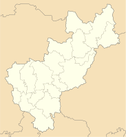
Coordinates: 21 ° 33 ′ N , 99 ° 41 ′ W Arroyo Seco on the map of Querétaro
|
||
| Basic data | ||
| Country | Mexico | |
| State | Querétaro | |
| Municipio | Arroyo Seco | |
| Residents | 1425 (2010) | |
| Detailed data | ||
| height | 985 m | |
| Post Code | 76440 | |
| Time zone | UTC −6 | |
| Website | ||
| Atrium cross in Arroyo Seco | ||
Arroyo Seco is a place with almost 1500 inhabitants in the north of the Mexican state of Querétaro . Arroyo Seco is the capital of the Municipio Arroyo Seco with over 80 villages and hamlets with a total of around 13,000 inhabitants.
location
Arroyo Seco is located on the northern slope of the Sierra Gorda near the border with the state of San Luis Potosí at an altitude of approx. 985 m above sea level. d. M. Santiago de Querétaro , the capital of the state, is about 240 km to the southwest; the place Jalpan de Serra is only about 50 km southeast. The climate is temperate; the average rainfall is 716 mm per year and mostly falls in the summer half-year.
Population and economy
Only a small number of the inhabitants of the community who immigrated from the north and who mostly belong to the Chichimec people speak their own language; also Nahuatl , the Aztec language has become rather rare; Colloquial language is mostly Spanish. The municipality is almost half covered by forest; another part is used as pasture. Corn, wheat, beans and vegetables are grown in the villages of the parish; there are also numerous fruit trees. Several small craft businesses and shops have sprung up in the village itself.
history
In the 15th century, the Aztecs conquered the region under Montezuma I (ruled 1440–1469). We know that in 1532 the Spanish conquistador Nuño Beltrán de Guzmán conquered the area and settled in the Concá area. By a decree of the viceroy Luis de Velasco y Castilla from the year 1609, the mission of proselytizing the Indians living here was placed in the hands of the Franciscan order . Particularly under the supervision of Fray Junípero Serra , several important Franciscan missions arose in the Sierra Gorda in the 1750s and 12760s - including one in Concá. During the Mexican Revolution (beginning in 1910), Arroyo Seco was attacked and occupied by the forces of General Saturnino Cedillo , killing many civilians. In 1933 the region was given municipal status.
Attractions
- In 1904 the construction of the Iglesia de Nuestra Señora de Guadalupe began , but its construction work was interrupted during the revolutionary years. The bell tower and transept were never completed. The nave is exposed to stone and has a groin vault ; the rear wall of the apse closes flat.
Surroundings
- Approx. 15 km to the southeast is the Franciscan church of San Miguel Arcángel von Concá, built between 1750 and 1754, with its brightly painted facade designed by Indian stonemasons. A kind of coat of arms consisting of two raised arms, whose hands are nailed to the cross in the middle, is emblazoned above the portal of the church; it is sometimes interpreted as a symbol of the Trinity , but St. Spirit in the form of a dove. Instead, two angels with a crown or a Franciscan cord hover over the scene. The first yoke of the church contains a gallery ; two more groin vaulted nave bays and a transept adjoin. The crossing is raised by an octagonal drum with windows and a rising dome ; the apse is broken polygonally. To the right of the church is a two-arched capilla abierta .
- Approx. 25 km southwest of the village of Santa María de los Cocos , which has around 400 inhabitants, is the break-in doline of Sótano del Barro , one of the largest in the world.
Web links
- Enciclopedia de los Municipios y Delegaciones de México: Municipio de Arroyo Seco, history etc. - Maps, photos and information (Spanish)
- Municipio de Arroyo Seco, history etc. - map, photo and information (Spanish)
- Municipio Arroyo Seco - Photos

