
Balfrin
| Balfrin | ||
|---|---|---|
 Balfrin with Balfring Glacier and Schweibbach |
||
| height | 3796 m above sea level M. | |
| location | Canton of Valais , Switzerland | |
| Mountains | Valais Alps | |
| Dominance | 1.7 km → Ulrichshorn | |
| Notch height | 241 m ↓ Riedpass | |
| Coordinates | 634 130 / 109375 | |
|
||
| Normal way | via Bordierhütte and Gross Bigerhorn (T5 / WS-) | |

The Balfrin is 3796 m above sea level. M. high mountain in the Valais Alps in Switzerland. It is located south-southeast of Grächen and west of Saas-Balen and Saas-Grund . The mountain is the highest peak in a chain that extends from the Seetalhorn above Grächen to the Riedpass between the Balfrin and the Ulrichshorn . Due to this location, the Balfrin is in front of the much better known higher peaks of the Mischabel and the Nadelgrat ; the distance to the highest peak of this massif, the cathedral ( 4545 m above sea level)), is around 6 km.
Together with the Ulrichshorn and the Nadelgrat, the Balfrin forms a wide, northwest-facing arena in which the nutrient area of the Ried Glacier is located. Two other, smaller glaciers are located in the southeast ( Bidergletscher ) and north ( Balfringletscher ).
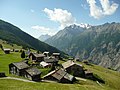
Due to the fact that the Balfrin, the most northerly notable glaciated peak , towers far above the junction of the Mattertal and Saas Valley near Stalden , it dominates the panorama when you look down from Visp into the valley. Equally spectacular and worthwhile is the view from the summit into the valley and to the four-thousand-meter peaks of the Weissmies group , the Mischabel and the Bernese Alps .
The Balfrin has a northern pre-summit with a height of 3783 m above sea level. M. (see picture on the right).
Climbing opportunities
Despite its considerable height, the Balfrin can be climbed as a difficult two-day alpine hike (T5 / WS-) in good conditions . The normal route leads from Gasenried near Grächen to the Bordierhütte at 2886 m above sea level in around 4 hours . M. to note is, that has to be crossed just before the hut of the Ried glacier. This happens in a flat, largely crevice-free area of the glacier. Above the hut, the ascent leads through scree slopes to the west ridge of the Gross Bigerhorn and from there over the connecting ridge and pre-summit to the Balfrin. The key point is a somewhat exposed rock step in difficulty level II .
Alternatively, the mountain can also be climbed as an alpine tour from the Mischabelhütte near Saas-Fee over the Windjoch , Brunegghorn and Riedpass (WS).
Höhenweg
The high path between Saas-Fee and the Hannigalp near Grächen is also called the Balfrin high path and runs above the tree line. The hike takes about 7 hours and is only recommended for hikers with a head for heights.
The path has been signposted by Wanderland Schweiz as regional route 27 "Swiss Tour Monte Rosa, Stage Grächen - Saas-Fee " since 2008 . It is also the 16th stage of the Saas-Fee - Grächen Alpine Pass Trail.
View of Gspon with Balfrin in the background.

Stock (small nose in front of the background mountains), at 2370 m above sea level. M. the highest point of the Balfrin Höhenweg.


Web links
- Balfrin on the ETHorama platform
- Alpine passes path No. 6.16 Saas-Fee - Grächen