Ball (Bergisch Gladbach)
|
ball
City of Bergisch Gladbach
Coordinates: 50 ° 59 ′ 13 ″ N , 7 ° 11 ′ 22 ″ E
|
||
|---|---|---|
| Height : | 240 m above sea level NN | |
| Postal code : | 51429 | |
|
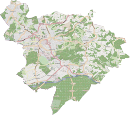
Location of Ball in Bergisch Gladbach |
||
|
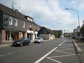
Ball in 2014 with an owner-run bakery and newsagents
|
||
Ball is a district in the Herkenrath district of Bergisch Gladbach .
history
The village of Ball is located in the center of Herkenrath. It is an early modern settlement that is recorded in the original cadastre as Am Ball .
According to the survey of the government district of Cöln , the place categorized as "farms" had three houses in 1845. At that time there were 18 people living in the village, all of them Catholic. In 1905 32 residential buildings with 192 residents were counted here.
The name ball allows two different interpretations: on the one hand, in Middle High German from “bal / balle” (= ball, sphere, ball), a topographical location on an elevation results . On the other hand, the Indo-European “bal” (= swamp) indicates a swampy soil structure at the time the settlement was founded, which is more likely.
literature
- H. Jakob Schmitz: The millennial Herkenrath , Heider-Verlag, Bergisch Gladbach 1950
Individual evidence
- ↑ Overview of the components and list of all the localities and individually named properties of the government district of Cologne: by districts, mayor's offices and parishes, with information on the number of people and the residential buildings, as well as the Confessions, Jurisdictions, Military and former state conditions. / ed. from the Royal Government of Cologne [Cologne], [1845]
- ^ Andree Schulte: Bergisch Gladbach, city history in street names , Bergisch Gladbach 1995, ISBN 3-9804448-0-5 , p. 196 f.

