Bir Umm Fawakhir
Bir Umm Fawakhir in Egypt |
Bir Umm Fawakhir is a former Coptic - Byzantine gold rush town in Egypt . It is located in the central Arabian desert , halfway between the Nile near Koptos and the Red Sea near al-Qusair , not far from Wadi Hammamat . The site is dated to the late 5th through 6th centuries.
It is the only ancient gold digging settlement in Egypt and one of the few in the Byzantine Empire that has been thoroughly archaeologically investigated.
Preoptic finds

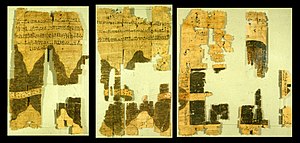
The ancient Egyptian Turin deposit papyrus from the 20th dynasty provides first indications of pre-Coptic activities . The remains of a temple of Ptolemy III date from Ptolemaic times . who was dedicated to the god Min . There are very few finds from Roman times , although the site has long been considered "Roman". This includes a signal tower that lined the Roman caravan route to the Red Sea with 59 other signal towers . There were also some Roman shards , pieces of faience and small Roman granite quarries. Published by Guéraud Ostraka evidence of military activity, but probably originate from the mines in the Wadi el-Sid .
In a nearby cave, Greek graffiti from the first three centuries and one in South Arabic were discovered.
raw materials
Bir Umm Fawakhir and the immediate area are located on Precambrian Fawakhir granite. The granite was used economically as a quarrying stone, served as an aquifer for the wells there and, above all, as a gold deposit. The gold lies as a quartz vein in the granite. In ancient times, the ore was mined in trenches on the surface or in shafts on the mountain sides. The quartz was chopped into pieces with small granite blocks and ground to a powder on concave grinders or a hand-held rotary mill . Many of the millstones used are still loose on the surface or have been reused for buildings. The powdered ore was probably washed at Bir Umm Fawakhir and transported to the Nile Valley for a final cleaning .
settlement
The archaeological remains of the main settlement lie in a long narrow wadi . The settlement is bordered by steep cliffs that look like a natural city wall . It consisted of over two hundred houses and outbuildings, as well as a main street with sandy soil . The ancient population of the main settlement is estimated at over 1000. The buildings were built from granite paving stones studded with small stones and broken pieces . Doors , benches , wall niches , troughs and stone boxes can still be seen in the ruins .
The most common house type has two to three rooms. Several such residential units can be combined to form houses with up to 22 rooms. There are also some separate, one-room outbuildings with a square or round floor plan , which may have been used for storage , kitchens , animal shelters, workshops or latrines .
graveyards
There are cemeteries on overhanging mountain ridges , all of which were looted . The graves are either boxes made of stone slabs or natural granite columns, which were sometimes too short so that the stored bodies had to be bent. Often there are also granite paving stones stacked on top of one another, around which Coptic-Byzantine pottery was scattered. Crosses distributed on dinnerware indicate a Christian population.
More buildings
On one of the highest mountain peaks there was a guard post with a view of the main settlement. Three streets led to the surrounding wells, some also to the mines and quarries. Otherwise there was no other defense structure . Other typical buildings such as churches , warehouses , stables, and administrative buildings were believed to be closer to the modern main road on the wadi water. Outside the main settlement there are fourteen other settlement heaps, one of which has over sixty buildings. The outlying settlements were constructed similarly and housed the same pottery.
meaning
The settlement is one of a few ancient gold digging sites, where not only the arrangement of the settlement, but also peripheral features such as B. industrial areas , streets, paths, wells, cemeteries and remote settlement heaps can be observed. According to ancient reports, the Arabian Desert in Byzantine Egypt was left to nomadic tribes . The lack of defensive structures in Bir Umm Fawakhir and the large number of other archaeologically investigated sites such as B. Abu Sha'ar , Berenike , Bir Nakheil , Khasm el-Menih and Mons Porphyrites point out, however, that the Byzantine government ruled the eastern desert and had considerable undertakings there.
literature
- O. Guéraud: Ostraca grecs et latins de l'Wâdi Fawâkhir. In: Bulletin de l'Institut français d'archéologie Orientale. (BIFAO) No. 41, 1942, pp. 141-196.
- Carol Meyer: Gold, granite, and water: The Bir Umm Fawakhir Survey 1992. In: Annual of the American Schools of Oriental Research. (AASOR) 1995.
- Carol Meyer: A Byzantine gold-mining town in the Eastern Desert of Egypt: Bir Umm Fawakhir 1992–1993. In: Journal of Roman Archeology. (JRA) No. 8, 1995, pp. 192-224.
- Carol Meyer: Bir Umm Fawakhir. In: Kathryn A. Bard (Ed.): Encyclopedia of the Archeology of Ancient Egypt. Routledge, London 1999, ISBN 0-415-18589-0 , pp. 175-177.
Web links
- Oriental Institute - The Bir Umm Fawakhir Project (English)
- Bir Umm Fawakhir: Insights into Ancient Egyptian Mining (English)
Individual evidence
- ^ A b c Carol Meyer: Wadi Hammamat in: Bard, Encyclopedia of the Archeology of Ancient Egypt , 1999, p. 176.
- ↑ Guéraud: Ostraca grecs et latins de l'Wâdi Fawâkhir. In: BIFAO No. 41, 1942, pp. 141-196.
- ^ A b c d Carol Meyer: Wadi Hammamat in: Bard, Encyclopedia of the Archeology of Ancient Egypt , 1999, p. 175.
- ↑ Carol Meyer: Wadi Hammamat in: Bard, Encyclopedia of the Archeology of Ancient Egypt , 1999, pp. 175-176.
Coordinates: 26 ° 0 ′ 37 " N , 33 ° 36 ′ 28.4" E
