Blerick
 flag |
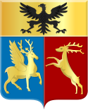
 coat of arms |
| province |
|
| local community |
|
|
Area - land - water |
34.99 km 2 34.19 km 2 0.8 km 2 |
| Residents | 27,440 (Jan. 1, 2018) |
| Coordinates | 51 ° 22 ′ N , 6 ° 9 ′ E |
| Important traffic route |
|
| prefix | 077 |
| Postcodes | 5921-5923 |
| Location of Blerick in the municipality of Venlo | |
Blerick ( Blierik in Limburg ) is the district of the city of Venlo on the left bank of the Meuse . Blerick is right between the A67 and A73 motorways . The district has 27,440 inhabitants (as of January 1, 2018). This makes Blerick the second largest district of Venlo in terms of population. Furthermore, Blerick is the largest district in the municipality of Venlo in terms of area. The district consists of the parts Blerick, Hout-Blerick and Boekend.
history
The name Blerick is derived from Blariacum , a Roman settlement. The actual Roman settlement was not in what is now Blerick, but presumably a little further south-west. Blerick has had many different names throughout history, including a. Blariacum, Blerke, Blerijck, Blerik, Blerick, Venlo-Blerick and Venlo-West. After 1794 the French army occupied the place and a new administration was created. Communities with fewer than 5000 inhabitants were merged into one community. Blerick, Baarlo , Bree and Mairie de Bree, later called Maasbree , became a unified municipality. In Blerick, the largest village in this municipality, there were efforts to become independent - but this did not succeed. Towards the end of the 19th century there was a housing shortage in neighboring Venlo, so more space was needed there. In the course of time the city of Venlo tried more and more often to detach Blerick from the municipality of Maasbree and to add it to the municipality of Venlo. In 1909 these efforts were decidedly rejected by Venlo in Blerick. Only in 1940 did the city of Venlo succeed in incorporating Blerick. On the morning of May 10, 1940, Wehrmacht troops marched into the Netherlands, Belgium and Luxembourg; the western campaign began. Blerick was liberated in early December 1944. Before that, 30,000 shells fell on Blerick. The Martinus Church was also destroyed. Venlo and districts on the east bank were not liberated until March 1, 1945.
Blerick in the 21st century
Today Blerick is a modern part of Venlo and no longer has a village character. Farms have made way for u. a. modern city apartments. Today, Blerick is also an important location for many industries. Blerick is an important hub in the transport world and is part of the extended BrabantStad : Breda - Tilburg - 's-Hertogenbosch - Eindhoven - Helmond with Venlo-Blerick. The urban district consists to a large extent of industrial areas, which take up about a quarter of the area. A large number of transport companies have therefore set up shop in the trade ports.
Problems with crime
Since 2018, the city has been trying to curb significant, drug-related crime, especially of the so-called Mocromaffia (drug traffickers of Moroccan origin ) and Turkish-Kurdish groups with increased use of the police and the judiciary. Vastenavondkamp should be emphasized as a problem area.
The districts and industrial areas
Districts
The district of Blerick does not only consist of Blerick itself, but also has to be divided into two further districts: Boekend and Hout-Blerick. Blerick itself consists of three different, official districts:
- Tuindorp
- Center
- Hazekamp
- Sint-Annakamp
- Vastenavondkamp
- Smeliënkamp
- Zonneveld
- Ubroek
- Vossener
- Klingerberg
Industrial areas
A quarter of Blerick is made up of industrial areas. These important economic areas in Blerick include:
- Venlo Trade Port
- Trade Port Noord
- Trade Port Oost
- Trade Port West
- Business Park Venlo
- Fresh Park Venlo
- Flora Trade Parc Venlo
- Ubroek
traffic
Rail transport
Blerick is located on the Staatslijn E ( Breda - Maastricht rail line ) and on the Maaslijn ( Venlo - Nijmegen rail line ). Furthermore, Blerick has had its own train station since 1868. In passenger transport there is an InterCity train connection of the Nederlandse Spoorwegen in the direction of Eindhoven , Rotterdam and The Hague . The Blerick train station is also a stop for Veolia Transport's private railway in the direction of Roermond and Nijmegen.
Road traffic
As an important industrial location, Blerick is located on two motorways:
- A67 : ( Ruhr area ) - Venlo - Eindhoven - Antwerp
- A73 : Nijmegen - Venlo - Roermond - Maasbracht - ( Maastricht / Liège )
Buildings
- Antonius Church
- Frederik-Hendrik-Kazerne
Sports
- SV Blerick (Football Club of the Dutch Regional League)
Personalities
- Mathieu Cordang (1869–1942), racing cyclist
- Coy Koopal (1932-2003), football player
- Willem JH Willems (1950-2014), archaeologist
- Rick Hoogendorp (* 1975), football player
Web links
Individual evidence
- ↑ a b Kerncijfers wijken en buurten 2018 Centraal Bureau voor de Statistiek , accessed on September 1, 2018 (Dutch)
- ↑ rp.-online.de (Rheinische Post) August 22, 2012: How Venlo fell to rubble
- ↑ Marco van Kampen and Harry Lücker: Problems Blerickse wijk nu really aangepakt. In: De Limburger . Media Groep Limburg, May 19, 2018, accessed March 3, 2019 (Dutch).
