Bockmattlistock
| Bockmattlistock | ||
|---|---|---|
|
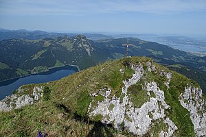
Southeast side of the Bockmattlistock |
||
| height | 1931 m above sea level M. | |
| location |
|
|
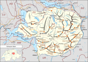
| Mountains | Schwyz Alps | |
| Dominance | 0.73 km → Schiberg | |
| Notch height | 64 m ↓ In the Stotzigen | |
| Coordinates | 715 381 / 217 734 | |
|
|
||
| particularities | popular climbing mountain | |
The Bockmattlistock (named after the Gamsbock ) is 1931 m above sea level. M. high mountain in the Schwyz Alps and a secondary peak of the Tierberg , 1988 m . It is located about three kilometers as the crow flies east of Innerthal on the Wägitalersee and about 8 km west of Näfels . The summit is located in the canton of Schwyz, not far from the border with the canton of Glarus . The Bockmattlipass , a little further south on the canton border at an altitude of 1796 m , connects the Wägital with the Oberseetal . The Bockmattli is a popular hiking and climbing area with some difficult routes .
Bases and paths
The base for the ascent is the Obersee ( 990 m ) to the east- south- east , above Näfels . From there, a path leads west over the Bockmattlipassweg to Ahornenälpli ( 1404 m ). Then we continue on a path with rope insurance over the ridge to the summit. According to the literature, the walking time is 2 ½ hours. Alternatively, you can ascend from the Wägitalersee. Follow the path from Innerthal to Schwarzenegghöhe and from there to Bockmattlihütte ( 1501 m ) with overnight accommodation. It continues in two and a half hours through the Gross Chälen and over the Bockmattliwiese to the summit.
Climbing routes
There are a number of difficult climbing routes in mostly good limestone on the Bockmattli towers to the northwest . From the Bockmattlihütte you can see the west face of the small tower with routes of difficulty AS and the nameless edge ( SS + ). The Westpfeiler (AS +) and Westriss / Westkante (S) routes are located in the west basin . The impressive north walls with extreme routes can be seen from the Schwarzenegghöhe : Small Bockmattliturm, north face (AS), Föhrenturm north face (AS), large Bockmattliturm, direct north face (AS +), supertramp (EX and more difficult), north-west face (AS), east tower, north face (AS +) and other challenging climbs.
outlook
Web links
- Bockmattli tour reports and photos
- Bockmattli climbing hut
Literature and map
- Swiss Alpine Club (publisher), Glarner Alpen Alpine Guide, SAC publishing house, 2004, ISBN 3-85902-224-5
- National map of Switzerland 1: 25,000, sheets 1133, Linth plain and 1153, Klöntal
proof
- ↑ a b c d Maps of Switzerland (SwissTopo)
- ↑ Ernst Höhne: Knaurs Lexikon für Bergfreunde / The Alps between Matterhorn and Lake Constance . Droemer Knaur, Munich 1987, ISBN 3-426-26223-1 , p. 195 .


