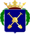
Bodegraven
 flag |
 coat of arms |
| province |
|
| local community |
|
|
Area - land - water |
26.54 km 2 25.84 km 2 0.7 km 2 |
| Residents | 18,035 (Jan. 1, 2017) |
| Coordinates | 52 ° 5 ' N , 4 ° 45' E |
| Important traffic route |
|
| prefix | 0172 |
| Postcodes | 1079, 2411 |
Bodegraven ( ) is a small town and a former municipality in the Dutch province of South Holland . The parish also included the small villages of Meije and Nieuwerbrug. 19,432 people lived in the community (as of December 31, 2010). The total surface of the municipality was 38.5 km² (land: 37.49 km², water: 1.01 km²).
Bodegraven has been the seat of the municipality of Bodegraven-Reeuwijk since January 1, 2011 .
Location and economy
Bodegraven is located on the Oude Rijn river , between Alphen aan den Rijn and Woerden . The city has a train station on the Leiden - Utrecht railway line . The A12 motorway (Utrecht - Gouda - Rotterdam / The Hague ) has an exit to Bodegraven.
Bodegraven lives from dairy farming and above all from the food industry derived from it : cheese , (the nationally known company Frico), dairy products, etc.
history
The place where Bodegraven is located marked the border of the Roman Empire in the 1st century . In the “Museum voor Oudheden” in Leiden there is a rider's helmet made of gilt bronze that was excavated in Bodegraven in 1937 and belonged to a Roman soldier. Presumably a "castellum" of a Roman legion was located here . Interesting finds were also made during excavations in 1994, which are exhibited in a showcase in the town hall.
Little more is known about the history up to 1600. Much was lost in city fires in the Middle Ages and in the 17th century. So it is uncertain whether Bodegraven had city rights in the past . It is also uncertain whether the place is a town or a village. In 1882 a cheese factory and wholesaler was founded, to which Bodegraven owes its economic prosperity to this day.
Attractions
- There is a small cheese museum near the train station, which is only open on Saturdays.
- The Wierickerschans ski jump , in a picturesque polder landscape, dates from the 17th century and can be visited in summer by appointment with a guide
- To the north of the village are the Nieuwkoopse Plassen (lakes), a bird sanctuary
- The village of Nieuwerbrug ( German New Bridge ) has a customs bridge from 1609
- One can from here cycling through the Dutch polder landscape with its many old windmills make
- Bodegraven has a 17th century church.
traffic
Rail transport
The city has a train station on the Leiden - Utrecht railway line .
Road traffic
The national road N11 and the A12 motorway intersect near the city.
Transportation
From Bodegraven there is a bus to Gouda (line 178), Alphen aan den Rijn (line 722) and Woerden via de Meije (line 724).
politics
Distribution of seats in the municipal council
| Political party | Seats | |||
|---|---|---|---|---|
| 1994 | 1998 | 2002 | 2006 | |
| Praying Bodegraven | 5 | 5 | 4th | 4th |
| CDA | 5 | 5 | 5 | 4th |
| PvdA | 2 | 2 | 2 | 3 |
| ChristenUnie | - | - | 2 | 2 |
| VVD | 2 | 2 | 2 | 2 |
| SGP | 1 | 1 | 2 | 1 |
| GroenLinks | - | - | - | 1 |
| RPF / GPV | 1 | 2 | - | - |
| D66 | 1 | 0 | - | - |
| Algemeen Ouderen Verbond / Unie55 + | - | 0 | - | - |
| total | 17th | 17th | 17th | 17th |
Web links
- Website of the municipality of Bodegraven-Reeuwijk (Dutch)
- Website of the region's tourist board (Dutch, German, English, French)
Individual evidence
- ↑ Kerncijfers wijken en buurten 2017 Centraal Bureau voor de Statistiek , accessed on May 21, 2018 (Dutch)
- ↑ Bevolkingsontwikkeling; regio per maand Centraal Bureau voor de Statistiek , accessed on May 21, 2018 (Dutch)
- ↑ Kerncijfers wijken en buurten 2009-2012 Centraal Bureau voor de Statistiek , accessed on May 21, 2018 (Dutch)
- ↑ Allocation of seats in the municipal council: 1994–2002 2006 , accessed on May 21, 2018 (Dutch)


