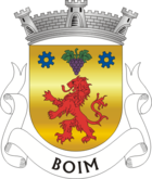
Boim (Lousada)
| Boim | ||||||
|---|---|---|---|---|---|---|
|
||||||
| Basic data | ||||||
| Region : | Norte | |||||
| Sub-region : | Tâmega e Sousa | |||||
| District : | postage | |||||
| Concelho : | Lousada | |||||
| Coordinates : | 41 ° 16 ′ N , 8 ° 17 ′ W | |||||
| Residents: | 3109 (as of June 30, 2011) | |||||
| Surface: | 3.43 km² (as of January 1, 2010) | |||||
| Population density : | 906 inhabitants per km² | |||||
| Postal code : | 4620-184 | |||||
| politics | ||||||
| Mayor : | Dora Manuela Moreira da Rocha Santos ( PS ) | |||||
| Address of the municipal administration: | Junta de Freguesia de Boim Rua General Humberto Delgado, n.º 4 4620-184 Boim |
|||||
| Website: | www.boim.pt | |||||
Boim is a municipality ( freguesia ) in the Portuguese district ( concelho ) of Lousada . It has a population of 3109 (as of June 30, 2011).
history
The place name probably goes back to a Celtic name. One theory sees the word goi as the origin, which referred to a mushroom considered sacred, in connection with which ceremonies took place in the place. The Romans , Visigoths and finally the Arabs changed the name to the current form via Goim , Guym and Aboim . A second theory sees a Celtiberian warrior living here at the origin, whose Latinized name was Abolinus , and from which the current place name developed through subsequent peoples and cultures, similar to the one described in the first theory.
In the royal surveys of 1258 the place was already run as an independent parish.
Culture and sights
In addition to the chapel Capela de São Jorge , the parish church Igreja Paroquial de Boim ( also Igreja de São Vicente after its patron saint ) from the 16th century is a listed building.
Every year on the last Sunday of January the parish festival in honor of Saint Vincent (Portuguese: São Vicente) takes place, and on the last Sunday in April the parish dedicates a festival to Saint George (Portuguese: São Jorge).
economy
The textile and shoe industry is important in the municipality, especially in the municipality's industrial park, the Parque Industrial .
administration
Boim is the seat of the homonymous municipality ( Freguesia ). The following localities are in the municipality:
|
|
|
|
Web links
Individual evidence
- ↑ a b www.ine.pt - indicator resident population by place of residence and sex; Decennial in the database of the Instituto Nacional de Estatística
- ↑ Overview of code assignments from Freguesias on epp.eurostat.ec.europa.eu
- ↑ www.monumentos.pt (under Cronologia ), accessed on August 22, 2013
- ↑ ditto
- ↑ Congregation portrait on the official website ( memento of the original from November 6, 2013 in the Internet Archive ) Info: The archive link has been inserted automatically and has not yet been checked. Please check the original and archive link according to the instructions and then remove this notice. , accessed August 22, 2013


