Brazos River
| Brazos River | ||
|
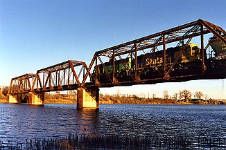
Bridge over the Brazos near Waco |
||
| Data | ||
| Water code | US : 1384148 | |
| location | Texas (USA) | |
| River system | Brazos River | |
| Confluence of |
Salt Fork Brazos River and Double Mountain Fork 33 ° 16 ′ 7 ″ N , 100 ° 0 ′ 37 ″ W. |
|
| Source height | 452 m | |
| muzzle |
Gulf of Mexico Coordinates: 28 ° 52 ′ 33 " N , 95 ° 22 ′ 42" W 28 ° 52 ′ 33 " N , 95 ° 22 ′ 42" W |
|
| Mouth height | 0 m | |
| Height difference | 452 m | |
| Bottom slope | 0.33 ‰ | |
| length | 1352 km (with source rivers: 2060 km)
|
|
| Catchment area | approx. 116,000 km² | |
| Discharge at the Rosharon gauge ( ⊙ ) A Eo : 91,579 km²
|
MQ 1968/2013 Mq 1968/2013 |
205 m³ / s 2.2 l / (s km²) |
| Left tributaries | Navasota River | |
| Right tributaries | Paluxy River | |
| Reservoirs flowed through | Possum Kingdom Lake , Lake Granbury , Lake Whitney | |
| Big cities | Waco | |
| Small towns | Richmond | |
|
Basin of the Brazos River |
||
The Brazos is the second longest river in the US state of Texas .
It rises 100 km north of Abilene and flows into the Gulf of Mexico after 2060 km at Freeport (90 km south of Houston ) .
Surname
The name of the river comes from the Spanish expression "Los brazos de dios", which means "the arms of God". Possibly the first drinkable water was meant after crossing the Llano Estacado desert .
economy
North of Waco, the Brazos is dammed up three times to generate electricity and forms the lakes Possum Kingdom Lake , Lake Granbury and Lake Whitney .
Places on the Brazos
- Seymour , Graham , Palo Pinto , Mineral Wells
- Granbury , Glen Rose , Waco , Marlon
- Bryan , Navasota , Hempstead , Brazoria
Web links
Commons : Brazos River - collection of images, videos and audio files

