Brighton, Alabama
| Brighton | |
|---|---|
|
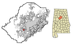
Location in County and Alabama
|
|
| Basic data | |
| Foundation : | 1892 |
| State : | United States |
| State : | Alabama |
| County : | Jefferson County |
| Coordinates : | 33 ° 26 ′ N , 86 ° 57 ′ W |
| Time zone : | Central ( UTC − 6 / −5 ) |
| Residents : | 2,896 (as of 2013) |
| Population density : | 804.4 inhabitants per km 2 |
| Area : | 3.6 km 2 (approx. 1 mi 2 ) of which 3.6 km 2 (approx. 1 mi 2 ) are land |
| Height : | 155 m |
| Postal code : | 35020 |
| Area code : | +1 205 |
| FIPS : | 01-09400 |
| GNIS ID : | 0114914 |
Brighton is a city in Jefferson County in the state of Alabama in the United States .
geography
Brighton is located in central Alabama in the southern United States. It is part of the Birmingham – Hoover metropolitan area .
Nearby locations include Bessemer (immediately south), Midfield (immediately north), Birmingham (immediately east), Hueytown (2 km west), and Pleasant Grove (2 km north).
history
The city was founded in 1892 as Woodward Crossing and renamed in 1894 when the post office opened in reference to the southern English city of Brighton . Around 1901 there were about 100 families in Brighton. The city's growth has always been closely linked to the Woodward Iron Company , which was one of the nation's leading producers of pig iron in the 1920s ; When this ceased operations in the 1970s, the importance and size of the city also decreased significantly.
traffic
Along the western outskirts of the city, Interstate 20 , which runs 2,470 kilometers from Texas to South Carolina , and Interstate 59 , which runs from Louisiana to Georgia , run on a shared route . Alabama State Route 5 runs on the eastern outskirts and connects to Interstate 65 about 12 kilometers northeast .
Bessemer Airport is about 12 kilometers south , and Birmingham-Shuttlesworth International Airport is 19 kilometers northeast .
Demographics
The 2000 census showed a population of 3,640, divided into 1,413 households and 921 families. The population density was 1004 people per square kilometer. 89.1% of the population were black, 9% white, 0.4% American Indian, 0.03% Asian and 0.03% Pacific islander. 0.9% were of a different ethnicity , 0.6% had two or more ethnicities, and 1.7% were Hispanic or Latin American of any ethnicity. For every 100 women there were 87 men. The median age was 38 and the per capita income was $ 11,002, which was 27.2% of the population below the poverty line.
By the 2010 census , the population had dropped to 2,945; in 2013 it was an estimated 2,896.
Personalities
- Albert Hall (born 1937), actor
- Parnell Dickinson (born 1953), former football player
Web links
- Statistical data on Brighton (Engl.)
- Brighton in the Encyclopedia of Alabama (Engl.)
