Catió
| Catió | ||
|---|---|---|
|
|
||
| Coordinates | 11 ° 17 ′ N , 15 ° 15 ′ W | |
| Basic data | ||
| Country | Guinea-Bissau | |
| Sul | ||
| region | Tombali | |
| ISO 3166-2 | GW-TO | |
| surface | 1,020.1 km² | |
| Residents | 26,999 (2009) | |
| density | 26.5 Ew. / km² | |
|
The coat of arms of the small town of Catió from Portuguese colonial times
|
||
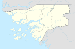
Catió is a city in southwest Guinea-Bissau with about 9800 inhabitants. It is the capital of the Tombali region and the seat of the sector of the same name with an area of 1020 km² and 26,999 inhabitants (as of 2009).
During the Portuguese colonial war , which lasted from 1963 to 1974 in Guinea-Bissau and was particularly intense, the area of today's Catió was the scene of Portuguese commandos and sieges several times .
Economy and sights
Agriculture determines the economy in the Catió sector, especially rice, mangos, cassava and oil palms, but mostly only in subsistence farming . Fishing in the surrounding rivers should also be mentioned.
The Parque Nacional das Florestas de Cantanhez National Park begins south of Catió . The geographical remoteness of the region and the poor road connection to the rest of the country ensure that nature is largely intact. The jungle of Cantanhez with its lush flora and fauna with numerous mammals, amphibians and birds can therefore develop largely unaffected in the 1,057 km² area. Catió offers itself as an introduction to the nature park, which the WWF counts as one of the 12 most important WWF ecoregions on earth, in which trained park rangers and guides lead visitors along various routes through the area.
structure
The Catió sector includes around 100 localities, mostly rural villages ( Tabancas ).
The sector capital Catió is divided into 11 districts ( Bairros ). The most important locations in the sector also include:
- Baria (a Balanta village with 148 and two Nalu villages with 256 and 82 inhabitants respectively)
- Botche Bissa
- Caliu
- Cufar
- Gandua (a Balanta village with 403, a Biafada village with 331 and a Nalu village with 2018 inhabitants)
- Mato Faroba
Two islands also belong to the Catió sector:
- Ilheu de Colbert (two localities: a Balanta village with 119 and a Pepel village with 209 inhabitants)
- Ilha de Infanda (a village with 969 inhabitants)
traffic
Catió is the end of a mostly poorly developed road that leads from the town of Buba, about 60 km northeast .
In nearby Cufar , a town in the Catió sector, there is an airport with the ICAO code GGCF.
Town twinning
-
 Portugal : Anadia
-
 Portugal : Santa Maria da Feira (cooperation agreement since 2006)
sons and daughters of the town
- Baciro Candé (* 1948), former soccer player, national coach of Guinea-Bissau since 2016
- Batista Tagme Na Waie (1949–2009), General, Army Commander of the Armed Forces of Guinea-Bissau until his assassination
- Abdulai Silá (* 1958), Guinea-Bissau engineer, economist, writer and publicist
Web links
Individual evidence
- ↑ Annual Statistical Report Guinea-Bissau 2015 (p. 10), PDF available from the National Statistics Office INE on December 9, 2017
- ↑ Inhabitants by region, sector and town by gender, 2009 census (p. 1, port.), PDF access from the INE National Statistics Office of December 15, 2017
- ↑ a b Joana Petrolho, Marta Rosa: À Descoberta da Guiné-Bissau . , Afectos com Letras / EU, Pombal 2015, ISBN 978-989-20-6252-5 , p. 93 ff.
- ↑ Geminações de Cidades e Vilas. Associação Nacional de Municípios Portugueses, accessed December 9, 2017 (Portuguese).


