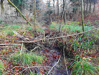
Chüewaldbach
|
Chüewaldbach gate |
||
|
Chüewaldbach im Birrmatthäuli , Birmensdorf |
||
| Data | ||
| Water code | CH : 12680 | |
| location | Switzerland | |
| River system | Rhine | |
| Drain over | Geissweidbach → Lunnerenbach → Reppisch → Limmat → Aare → Rhine → North Sea | |
| source | at the Chüewald farm 47 ° 19 ′ 45 ″ N , 8 ° 25 ′ 22 ″ E |
|
| Source height | 621 m above sea level M. | |
| muzzle | at Litzibuch in the Geissweidbach coordinates: 47 ° 19 '52 " N , 8 ° 24' 41" E ; CH1903: 673 527 / 242 703 47 ° 19 '52 " N , 8 ° 24' 41" O |
|
| Mouth height | approx. 579 m above sea level M. | |
| Height difference | approx. 42 m | |
| Bottom slope | approx. 38 ‰ | |
| length | 1.1 km | |
| Communities | Aesch , Oberwil-Lieli | |
|
Chüewaldbach in Birrmatthäuli |
||
The Chüewaldbach (in Aargau Gatter , after the corridor Litzibuecher Gatter ) is a 1.1 kilometer long right tributary of the Geissweidbach in the communities of Aesch and Oberwil-Lieli in the cantons of Aargau and Zurich . It drains part of the Hell forest area in the center of the Holzbirrliberg range of hills.
geography
course
The Chüewaldbach rises at 621 m above sea level. M. at a crossroads a little northwest of the Chüewald farm on the southern edge of the forest of the Widenhaus . The source is embedded between the 633 m above sea level. M. high wooded hill Chalberhau in the north and a hill around the Chüewald farm in the south.
It follows the Chüewaldstrasse to the west on the left, which briefly separates the Chalberhau from a field before the Tädiken forest area connects . It turns to the northwest and overturned under the southwestern part of the Birchmatt and the Chüewaldstrasse , which it now follows on the right along the edge of the forest. It flows north for a short time before taking a north-westerly course at Birchmatthäuli, crossing a broad strip of forest from east to west.
At the Litzibuecher gate he reaches the northern edge of the forest of the Aescherbüels and turns briefly to the west, then to the south-west. It now crosses the canton border and makes a sharp curve to the north in the direction of the Litzibuch farm and immediately afterwards again to the west. Shortly before the mouth, the stream is overturned, where it crosses under a crossroads. It finally flows into about 579 m above sea level. M. from the right into the upper reaches of the also gutted Geissweidbach, which is also called Tädikerbächli here .
Web links
- Course of the Chüewaldbach on GIS Zurich
- Course of the Chüewaldbach on the geoserver of the Swiss federal administration
swell
Individual evidence
- ↑ a b individual records of the geographic information system of the canton of Zurich
- ↑ a b Geographic information system of the Canton of Aargau

