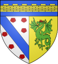
Chaméane
| Chaméane | ||
|---|---|---|

|
|
|
| local community | Le Vernet-Chaméane | |
| region | Auvergne-Rhône-Alpes | |
| Department | Puy-de-Dôme | |
| Arrondissement | Issoire | |
| Coordinates | 45 ° 31 ' N , 3 ° 27' E | |
| Post Code | 63580 | |
| Former INSEE code | 63078 | |
| Incorporation | 1st January 2019 | |
| status | Commune déléguée | |
Chaméane is a commune Déléguée in the French commune of Le Vernet-Chaméane with 162 inhabitants (as of January 1 2017) in the department of Puy-de-Dôme in the region Auvergne Rhône-Alpes (before 2016 Auvergne ).
The municipality of Chaméane merged with Vernet-la-Varenne on January 1, 2019 to form the Commune nouvelle Le Vernet-Chaméane. Since then it has had the status of a Commune déléguée. The municipality of Chaméane was part of the Arrondissement of Issoire and the canton of Brassac-les-Mines (until 2015: Canton Sauxillanges ).
geography
Chaméane is located about 44 kilometers south-southeast of Clermont-Ferrand . The municipality of Chaméane was surrounded by the neighboring municipalities of Saint-Quentin-sur-Sauxillanges in the north and north-west, Saint-Genès-la-Tourette in the east and north-east, Vernet-la-Varenne in the south and Saint-Étienne-sur-Usson in the west.
Population development
| year | 1962 | 1968 | 1975 | 1982 | 1990 | 1999 | 2006 | 2013 |
| Residents | 165 | 157 | 144 | 145 | 147 | 132 | 140 | 151 |
| Source: Cassini and INSEE | ||||||||
Attractions
- Saint-Pierre-aux-Liens church from the 11th century
- 16th century castle
