Cheshire, Massachusetts
| Cheshire | |
|---|---|
 |
|
| Location in Massachusetts | |
| Basic data | |
| Foundation : | 1766 |
| State : | United States |
| State : | Massachusetts |
| County : | Berkshire County |
| Coordinates : | 42 ° 34 ′ N , 73 ° 10 ′ W |
| Time zone : | Eastern ( UTC − 5 / −4 ) |
| Residents : | 3,401 (as of: 2000) |
| Population density : | 48.7 inhabitants per km 2 |
| Area : | 71.4 km 2 (approx. 28 mi 2 ) of which 69.8 km 2 (approx. 27 mi 2 ) is land |
| Height : | 294 m |
| Postal code : | 01225 |
| FIPS : | 25-133345 |
| GNIS ID : | 0618264 |
Cheshire is a town in Berkshire County in western US -amerikanischen state of Massachusetts .
geography
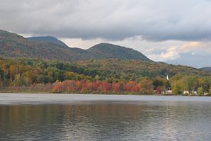
The town of Cheshire is located in the valley of the Hoosic River on a reservoir for flood protection , surrounded by Mount Greylock and the North Mountain . The Appalachian Trail also runs through the town.
history
Cheshire was founded in 1766 and gained independence in 1793. The place was named after the northwestern English county of Cheshire . In the 1793 election, the town was the only one in the county to vote for Thomas Jefferson . As a testament to the new president's support, the site sent him the 560 kg Cheshire Mammoth Cheese , which was transported on six horses and over water to Washington, DC . The industry initially consisted of blacksmiths , tanneries, and sawmills and grain mills . In 1812 a glass factory and in 1827 a cotton factory with 14 water-powered looms were opened. Today tourism is the main source of income for the residents.
traffic
Cheshire is on New England Interstate Route 8 , which runs north-south through town. In addition, the Massachusetts State Route 116 runs in the northeast through the place.
