Cibin
|
Cibin Zibin |
||
|
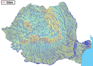
The Cibin in Romania |
||
| Data | ||
| location | Transylvania , Romania | |
| River system | Danube | |
| Drain over | Olt → Danube → Black Sea | |
| source | In Gura Râului in Cindrel Mountains | |
| Source height | 2000 m | |
| muzzle | At Tălmaciu in the Olt Coordinates: 45 ° 38 ′ 49 " N , 24 ° 17 ′ 31" E 45 ° 38 ′ 49 " N , 24 ° 17 ′ 31" E |
|
| Mouth height | 380 m | |
| Height difference | 1620 m | |
| Bottom slope | 20 ‰ | |
| length | 82 km | |
| Catchment area | 2184 km² | |
| Drain |
MQ |
14.7 m³ / s |
| Left tributaries | Sălişte , Hârtibaciu | |
| Right tributaries | Sadu | |
| Big cities | Sibiu | |
| Small towns | Tălmaciu | |
| Communities | Gura Râului , Orlat , Cristian , Șelimbăr | |
|
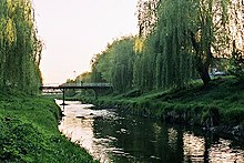
On the upper reaches of the Zibin in Gura Râului |
||
The Cibin (German Zibin , Transylvanian-Saxon : Zebeng , Hungarian Szeben ) is an 82 kilometer long right tributary of the Alt (Romanian Olt ) in Transylvania . According to one of several theories, the German name of the country "Transylvania" is derived from the Hungarian name of the zibin - "Szeben".
Its headwaters are the Zibins Mountains (Rum. Munții Cindrel ) in the Romanian Southern Carpathians. It has two source rivers, the Râul Mare (German for large river ) and the Râul Mic (German for small river ). After the union of these two source rivers, the Cibin flows through the Gura Râului reservoir . At Talmesch (Roman. Tălmaciu ) it flows into the Olt.
Tributaries are the Hârtibaciu (Eng. Harbach ) and the Zoodt (Rum. Sadu ). The most important town through which the water flows is Hermannstadt (Rum. Sibiu ).
Web links & sources
- On the theory "Transylvania from Szeben" ( Memento from September 28, 2007 in the Internet Archive ) (PDF; 79 kB)
- Sibiu County Council website


