Clynnog Fawr
|
Clynnog Fawr Welsh Clynnog Fawr |
||
|---|---|---|
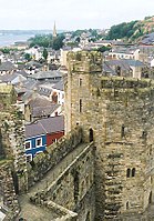
| View over the castle to the city | ||
| Coordinates | 53 ° 1 ′ N , 4 ° 22 ′ W | |
| OS National Grid | SH485625 | |
|
|
||
| Residents | 997 (2011) | |
| administration | ||
| Post town | CAERNARFON | |
| ZIP code section | LL55 | |
| prefix | 01286 | |
| Part of the country | Wales | |
| Preserved County | Gwynedd | |
| Unitary authority | Gwynedd | |
| British Parliament | Dwyfor Meirionnydd | |
| Welsh Parliament | Dwyfor Meirionnydd | |
| Website: www.caernarfononline.co.uk | ||
Clynnog Fawr (often short Clynnog ) is a village and community on the north coast of the Lleyn Peninsula in Gwynedd in north-west Wales .
geography
Clynnog Fawr is on the A499 between Caernarfon and Pwllheli . In the south some hills rise up to 400 m at Gyrn Goch ( Bwlch Mawr ). Clyynog itself is located in the narrow strip of the coastal plain, which widens from there north to inland. The closest settlements east of Clynnog are Capeluchaf and Tai'n Lon . In the north, Aberdesach and Pontllyfni join. The hinterland in particular is divided by a network of hedges and small streams. The population was given in 2011 with 997 inhabitants. The community includes an area of 4,551 hectares (17.57 mi² ). The parish church of St. Beuno , which appears oversized for the place, is defining the townscape . It is dedicated to Saint Beuno .
history
There is said to have been an Irish monastery that was founded by Beuno in the early 7th century. Clynnog means, like the Breton Quelneuc ( Kelenneg ) and the Gaelic Cuilneach : "Place with holly ". It developed into an important center and some Welsh law manuscripts record that the Abbot of Clynnog had a seat at the court of the King of Gwynedd .

The church was destroyed in 978 by the Vikings and later again by the Normans . It was a collegiate church in the late 15th century , one of only six parishes of its type in Wales. It was also an important stopping point for pilgrims en route to Bardsey Island . The Cyff Beuno , an old wooden chest hollowed out from a single piece of an aspen trunk and used to store the alms donated by the pilgrims. Maen Beuno (Beuno's stones) shows imprints, which are called imprints of Beuno's fingers. In the churchyard there is a canonical sundial from the 10th century to the early 12th century. Ffynnon Beuno (Beunos source) is a contained, listed source (Grade II *) in the southwest of the village.
The church is still an important point on the North Wales Pilgrims Way .
Several battles were also fought in the area, including the Battle of Bron yr Erw (1075) when Gruffydd ap Cynan's first attempt to become King of Gwynedd was repulsed by Trahern ap Caradog , and the Battle of Bryn Derwin (1255) when Llywelyn ap Gruffudd defeated his brothers Owain Goch ap Gruffydd and Dafydd ap Gruffydd and thereby became the sole ruler of Gwynedd.
society
There is a neighborhood policing team in Clynnog (in Penygroes).
The Clynog Golf Club was established shortly after the First World War and dissolved again in the 1920s.
The Clynnog Electoral Ward elects an MP to the Gwynedd Council .
Demographics
Since 2001 the population in Clynnog has increased.
In 2011, 73.2% of the population could speak Welsh .
Personalities
- Maurice Clennock (Morus Clynnog), Catholic Recuse and Head of the English College in Rome
- John Jones (martyr) , saint, 16th century.
Individual evidence
- ↑ Town population 2011 . Retrieved May 15, 2015.
- ↑ geonames.org .
- ^ Community / Ward population 2011 .
- ↑ Area: Clynnog (Parish) Office for National Statistics .
- ↑ taith Pererin Gogledd Cymru ~ North Wales Pilgrim's Way. pilgrims-way-north-wales.org.
- ↑ Clynog Golf Club . "Golf's Missing Links".
- ↑ Area: Clocaenog (Parish) . Office for National Statistics .


