Cumberland (Rhode Island)
| Cumberland | ||
|---|---|---|
|
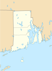
Location in Rhode Island
|
||
| Basic data | ||
| Foundation : | 1635 | |
| State : | United States | |
| State : | Rhode Island | |
| County : | Providence County | |
| Coordinates : | 41 ° 57 ′ N , 71 ° 25 ′ W | |
| Time zone : | Eastern ( UTC − 5 / −4 ) | |
| Residents : | 33,506 (as of 2010) | |
| Population density : | 482.8 inhabitants per km 2 | |
| Area : | 73.2 km 2 (approx. 28 mi 2 ) of which 69.4 km 2 (approx. 27 mi 2 ) is land |
|
| Height : | 81 m | |
| Postal code : | 02864 | |
| Area code : | +1 401 | |
| FIPS : | 44-20080 | |
| GNIS ID : | 1220068 | |
| Website : | www.cumberlandri.org | |
Cumberland is a town ( Town ) in Providence County , Rhode Iceland in the United States . It is located in the northeast of the state of Rhode Island on the border with Massachusetts , about 200 km northeast of New York .
geography
The urban area of Cumberland is 73.2 km² and is located on the east side of the Blackstone River, which flows close to the west of Cumberland in the Blackstone Valley , an area with numerous historical reserves in New England . The nearest major towns are Woonsocket , about three miles north of Cumberland, and Providence , about ten kilometers south. The main traffic connection is via the Interstate I-295 , a relief stretch of the I-95 , which runs about two kilometers south of Cumberland in an east-west direction.
The city has five elementary schools, two middle schools, and the Cumberland High School. There is also a private Roman Catholic school, Mercymount Country Day School , in Cumberland. Around a dozen structures in the city are inscribed on the National Register of Historic Places .
The mineral cumberlandite , an iron mineral, occurs in the urban area of Cumberland and is named after the city. Another geological feature is Diamond Hill , a massive outcrop of white quartz rock that is now located in a city park.
population
At the 2000 census , Cumberland had 31,840 residents. Almost 97% of them were white , the remainder were African-Americans and Asians, as well as small proportions of other ethnic groups. The per capita income was $ 25,592, just under three percent of the population lived below the poverty line . Cumberland has a large and active community of ex- Portuguese immigrants.
history
The first white settlement in Rhode Island took place on the area of today's Cumberland - at that time still part of Rehoboth, Massachusetts . The settler William Blaxton had settled there before the Pilgrim Fathers arrived. The actual settlement phase began in 1641, the settlement area grew through purchases made by the early settlers from the Indians. The settlement area under the name Attleborough Gore was divided for the first time in 1667, in 1746 after another division the name Cumberland was used and the settlement area was elevated to a city. From 1828 Pawtucket was independent.
sons and daughters of the town
- Latimer Whipple Ballou (1812-1900), politician
- Thomas Jenckes (1818–1875), politician
- Bobby Farrelly (* 1958), screenwriter, film producer and film director
Web links
Individual evidence
- ^ History of the State of Rhode Island . ( Memento of the original from October 3, 2011 in the Internet Archive ) Info: The archive link was inserted automatically and has not yet been checked. Please check the original and archive link according to the instructions and then remove this notice. Excerpt from the history of Rhode Island with illustrations by Albert J. Wright, 1878 (English)

