
Cumulonimbus

The cumulonimbus or cumulonimbus , ( lat. Cumulus "accumulation" and nimbus "rain cloud"; abbreviation : Cb , in Wegener also cumulo-nimbus or cu-ni ), German: thunderstorm cloud , is a type of cloud that is counted among the vertical clouds . Precipitation falls from it in the form of rain , hail , snow and it is often accompanied by thunderstorms. A distinction is made between Cumulonimbus calvus, Cumulonimbus capillatus, Cumulonimbus incus, Cumulonimbus pileus and other forms.
Dimensions
In Central Europe one can imagine a cumulonimbus as a cylinder with a diameter of 10 km, which extends from the approximately 500 m high cloud base to approximately 11 km in height. In the tropics, the summit is around 13 km.
construction
This cloud form consists mainly of water droplets (rain) in the lower layers or, in later stages of development, of hailstones that have formed at a height of a few kilometers. If the cloud pushes further upwards, ice crystals form and the cloud becomes blurred there.
Cumulonimbus clouds initially arise from small, "harmless" Cumulus Congestus or Castellanus clouds. If there is sufficient moisture supply and uplift drive with conditionally unstable air stratification, they grow noticeably ( moisture convection ) until they reach an equilibrium level, usually near a barrier layer ( temperature inversion ) or even the boundary layer of the troposphere ( tropopause ), and spread out horizontally there. This creates their typical anvil shape , which is why they are also called anvil clouds . In the updraft area, depending on the available instability energy, the convection shoots more or less far beyond the equilibrium level (overshooting top) - it penetrates the barrier layer.
When fully grown, this classic thundercloud brings massive showers and hail. It is also the cloud shape of cyclones and can contain 20 to 100 million tons of water. Strong winds are to be expected below and within these clouds. The vertical speeds can reach 120 km / h, with super cells even more. Up and down winds are close together here.
Cumulonimbs can appear in a linear arrangement along or in front of cold fronts (prefrontal convergence ). In warm air masses they also form larger cloud clusters , while in high-reaching, unstable cold air masses, a cellular pattern consisting of a large number of individual cumulonimbus clouds can be observed, especially over sea. In addition, tropical cyclones are mainly composed of cumulonimbes.
The meteorology differs according to size in the following ways:
- calvus - upper edge very limited, it is mostly only a transitional form.
- capillatus - frays heavily on its upper side, as it consists of ice particles.
- Cumulonimbus (capillatus) incus - the largest of the cumulonimbs, it is so swollen that it "spreads" like an anvil (incus) below the equilibrium level. Strong convective overshooting (overshooting top) is a sign of strong vertical winds within the cloud and indicates severe weather phenomena ( hail , gusts of wind , tornadoes ). Excessive convection is often not directly observable from the ground, since the extensive anvil or deep cloud cover obscures it.
- The pileus is a rounded ice cloud that hovers over the actual cumulonimbus. It arises, similar to a foehn cloud ( lenticularis ), when a sufficiently moist high-altitude current is lifted by the updrafts in the cloud and caused to condense.
For special forms, accompanying and mother clouds, see the article cloud .
Aviation Hazards
Because of the extreme turbulence inside, cumulonimbus clouds are dangerous even for large aircraft and are avoided, i.e. flown around or over. Using the electrical discharges, the cloud can be easily localized even in poor visibility, because the radio compass , which is set to frequencies in the long-wave range, always points to the center of thunderstorm activity.
Only two people are known to survive unprotected traversal of a cumulonimbus cloud:
- Fighter pilot William Rankin got out on July 26, 1959 while flying over a thunderstorm with the ejector seat, fell into the thundercloud and landed 40 minutes later in a forest. In addition to the fall injuries and frostbite, he also suffered from the effects of severe decompression and spent several weeks in the hospital.
- On February 14, 2007, paraglider pilot Ewa Wiśnierska was pulled sideways into a cumulonimbus cloud on a training flight in Australia and was torn by updrafts at an altitude of over 10,000 m. After three and a half hours of flight, it landed 60 km north of the launch site. She suffered frostbite on her face, ears and lower legs.
There are also reports from gliders and motor gliders.
gallery

Cb cloud with bag-shaped growths ( Mammatus )

Cumulonimbus cloud over Jena

Cumulonimbus cloud with a typical anvil
Cumulonimbus cloud with blown anvil

Towering cumulonimbus cloud

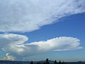
Cumulonimbus with pileus over Lake Constance

Cumulonimbus in the sunset over the Po Valley

Cumulonimbus capillatus incus over the Romanian Carpathian Mountains from the air


