Cunha (Sao Paulo)
| Cunha | |
|---|---|
|
Coordinates: 23 ° 4 ′ S , 44 ° 58 ′ W
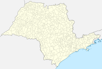
Cunha on the map of Sao Paulo
|
|
|
Location of the municipality of Cunha in the state of São Paulo
|
|
| Basic data | |
| Country | Brazil |
| State | São Paulo |
| City foundation | April 20, 1858 |
| Residents | 21,866 (IBGE / 2010) |
| City insignia | |
| Detailed data | |
| surface | 1,407.2 |
| Population density | 16 people / km 2 |
| height | 950 m |
| Post Code | 12530 |
| prefix | 12 |
| Time zone | UTC −3 |
| City Presidency | Rolien Guarda Garcia ( PSB ) |
| Website | |
| Today, Cunha is the Brazilian capital of the VW Beetle | |
Cunha is a small town with the status of a climatic health resort ( Estância Climática ) in the state of São Paulo in Brazil . The municipality has an area of 1410 km², had about 21,600 inhabitants according to official estimates in 2018 (downward trend) and is located in the highlands of the Alto Paraíba. The inhabitants live from agriculture. In the last few years tourism has been added as an economic factor. In addition to the agricultural zone, there are large natural areas in the municipality with the tropical rainforest of Mata Atlântica with a great variety of flora and fauna. The area includes the Serra do Quebra Cangalha Mountains and the Serra da Bocaina as a national park.
The municipality borders on the municipalities of Ubatuba , São Luiz de Paraitinga, Lagoinha, Guaratinguetá , Lorena , Silveiras, Areias, São José do Barreiro in the state of São Paulo and Angra dos Reis and Paraty in the state of Rio de Janeiro . From Paraty the federal road BR101 leads to Cunha, whereby the last 9 km are not paved and therefore impassable for normal cars in the rain. From Guaratinguetá, the valley of the Paraíba river and the Via Dutra motorway connection between Rio de Janeiro and São Paulo , it is about 33 km on the paved road SP-171 , which is a poor route to Cunha. There is also another road connection to Ubatuba in the state of São Paulo. Due to the bad roads, the historic VW Beetle has established itself as a car model because of its robustness. Although this car has not been produced for 20 years, there are said to be up to 1000 of these vehicles in the district of Cunha (see picture in front of the local market building).
history
The first Portuguese entered the area around Cunha in 1597 in an expedition of around 700 people that set out in Rio de Janeiro. The expedition was led by Martim Correa de Sá. The expedition was accompanied by approx. 2000 Indians, went ashore in the area around Paraty and climbed the Atlantic coastal mountains on the old way of the Guaianás Indians to fight Indians from the Tamoios tribe , who in turn supported the French against the Portuguese at that time.
A kind of health resort (with altitudes around 1000 meters), the area around Cunha around the year 1695. At that time many adventurers and gold miners used the old way of Guaianás to gems in this region and in the underlying areas of Minas Gerais search . With this, Cunha, which was also known as the entrance to the Sertão ( Boca do Sertão ), became famous. Cunha developed as a resting place for the adventurers and troops passing through. A place called Freguesia do Falcão was built as early as 1730 .
On September 15, 1785 , the place was founded with the name Vila de Nossa Senhora da Conceição de Cunha , in memory of General Francisco da Cunha Menezes, the governor of the province of São Paulo. At that time, the old roads were converted into roads so that the region's great wealth could be transported on them, coffee. The elevation to an independent municipality took place on April 20, 1858.
Individual evidence
- ↑ IBGE to Cunha. Retrieved May 25, 2019 .


