Tomaykichwa District
| Tomaykichwa District | |
|---|---|
 Location of the district in Ambo Province |
|
| Basic data | |
| Country | Peru |
| region | Huánuco |
| province | Ambo |
| Seat | Tomaykichwa |
| surface | 42.1 km² |
| Residents | 3382 (2017) |
| density | 80 inhabitants per km² |
| founding | December 18, 1935 |
| ISO 3166-2 | PE-HUC |
| Website | www.munitomaykichwa.gob.pe (Spanish) |
| politics | |
| Alcalde District | Juan Aguirre (2019-2022) |
Coordinates: 10 ° 4 ′ 38 ″ S , 76 ° 12 ′ 46 ″ W
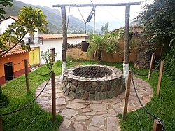
The district Tomaykichwa (alternative spelling: Tomay Kichwa or Tomayquichua ) is located in the province of Ambo in the Huánuco region in central Peru . The district was established on December 18, 1935. It has an area of 42.11 km². The 2017 census counted 3382 residents. In 1993 the population was 5625, in 2007 it was 4488. The administrative seat of the district is the small town of Tomaykichwa with 1950 inhabitants (as of 2017). This is located at an altitude of 2700 m on the right bank of the Río Huallaga , 5.5 km north of the provincial capital Ambo .
Geographical location
The Tomaykichwa district is located in the Peruvian Central Cordillera in the central north of the Ambo Province on the right bank of the Río Huallaga.
The district of Tomaykichwa borders in the west and in the north on the district Conchamarca , in the east on the district Molino ( province Pachitea ) and in the south on the district Ambo .
Individual evidence
- ↑ a b PERU: Huánuco region - provinces and districts . www.citypopulation.de. Retrieved February 21, 2020.
