Dreisbach (Ahr)
| Dreisbach | ||
|
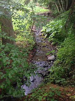
Dreisbach south of Wershofen |
||
| Data | ||
| Water code | DE : 271854 | |
| location |
Eifel
|
|
| River system | Rhine | |
| Drain over | Ahr → Rhine → North Sea | |
| source | In the forest area Auf der Luck between the districts of Rohr and Lommersdorf in the municipality of Blankenheim 50 ° 26 ′ 3 ″ N , 6 ° 44 ′ 24 ″ E |
|
| Source height | approx. 507 m above sea level NHN | |
| muzzle | At Fuchshofen in the Ahr coordinates: 50 ° 26 '1 " N , 6 ° 51' 26" E 50 ° 26 '1 " N , 6 ° 51' 26" E |
|
| Mouth height | approx. 256 m above sea level NHN | |
| Height difference | approx. 251 m | |
| Bottom slope | approx. 25 ‰ | |
| length | approx. 10 km | |
| Catchment area | 16.392 km² | |
| Communities | Blankenheim , Adenau | |
|
Dreisbach near the confluence of the Mutscheider Seifen |
||
The Dreisbach is a ten kilometer long orographically left tributary of the Ahr in North Rhine-Westphalia and Rhineland-Palatinate , Germany .
geography
course
The Dreisbach rises in the forest area Auf der Luck between the districts of Rohr and Lommersdorf of the municipality of Blankenheim near the state road 115 at an altitude of approx. 507 m above sea level. NHN . From here the stream flows to the northeast and after about one kilometer it crosses the border to Rhineland-Palatinate. It continues its course to the east, then flows south past the Adenauer local communities Ohlenhard and Wershofen . On the other side, across the Eichenbach , rises the highest mountain in the Ahrgebirge , the Aremberg . The Dreisbach flows into the Ahr Rhine tributary coming from the south at Fuchshofen at a height of around 256 m .
Catchment area and tributaries
On its ten kilometer long path, the brook overcomes a height difference of 251 meters, which corresponds to a mean bed gradient of 25 ‰. The 16.4 km² catchment area is drained to the North Sea via the Ahr and Rhine .
| Surname | GKZ | location | Length in km |
EZG in km² |
Mouth | Mouth height in m above sea level NHN |
|---|---|---|---|---|---|---|
| Forester soaps | 271854-12 | Left | 0.902 | 0.236 | Ohlenhard | 422 |
| Rump soaps | 271854-2 | Left | 0.726 | 0.401 | Ohlenhard | 399 |
| Schalkenbach | 271854-32 | right | 2,465 | 2.617 | Ohlenhard | 387 |
| Etzseifen | 271854-34 | right | 0.958 | 0.685 | 382 | |
| Owl soaps, also Keuvels soaps |
271854-36 | Left | 1.328 | 1,226 | 365 | |
| Divorce soaps | 271854-38 | right | 1.301 | 0.849 | 351 | |
| Keupelsseifen, also Mutscheider soaps |
271854-4 | Left | 0.828 | 0.815 | Wershofen | 340 |
| Take soaps | 271854-92 | Left | 0.828 | 0.815 | 317 | |
| Mührenseifen, also mill soaps |
271854-94 | Left | 0.944 | 0.808 | 301 | |
| Garbage soaps | 271854-96 | Left | 0.957 | 0.805 | 283 |
Sights and buildings
The former Dreisbachmühle is located near the confluence of the Mutscheider Seifen . The 16th century mill belonged to the Dukes of Arenberg and was in operation until the end of the 19th century.
Web links
Individual evidence
- ^ German basic map 1: 5000
- ↑ Map service of the landscape information system of the Rhineland-Palatinate nature conservation administration (LANIS map) ( notes )
- ↑ a b Water directory of the State Office for Nature, Environment and Consumer Protection NRW 2010 (XLS; 4.67 MB) ( Notes )
- ↑ GeoExplorer of the Rhineland-Palatinate Water Management Authority ( information )

