Meerberg
| Meerberg | ||
|---|---|---|
|
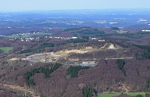
Meerberg with basalt quarry, aerial view |
||
| height | 429.1 m above sea level NHN | |
| location | Rhineland-Palatinate , Germany | |
| Mountains | Rheinwesterwälder volcanic ridge , Niederwesterwald | |
| Coordinates | 50 ° 36 '26 " N , 7 ° 17' 49" E | |
|
|
||
| rock | basalt | |
|
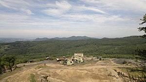
View from the summit of the Meerberg to the Siebengebirge |
||
The Meerberg (also Mehrberg or Düstemich ; earlier also Düsemich ) is 429.1 m above sea level. NHN , formerly 448 m , high mountain on the Rheinwesterwälder volcanic ridge or on the Linzer Höhe .
geography
The mountain, which was largely removed by a basalt quarry, is located above and southwest of Kretzhaus in the northern urban area of Linz am Rhein and marks its highest point. To the north and west it drops steeply into the Kasbachtal , in which the Kasbachtalbahn (Linz– Kalenborn ) and the Landesstraße 252 (Bruchhausen – Kretzhaus) also run. To the south it goes much more gently into its lower neighboring mountain, which is still around 405 m above sea level today . NHN high Minderberg over. The mountain top with a steep slope on the north side is not freely accessible.
geology
The type of rock that mainly occurs on the summit of the Meerberg is nepheline basanite , a volcanic alkali rock . It occurs or occurred partially in the form of basalt columns . In terms of minerals , apophyllite , calcite , chabazite , montmorillonite , natrolite and phillipsite were also found there. At the northern foot of the Meerberg there is a vein-shaped copper ore deposit on which the Clemenslust mine field was awarded.
history
Basalt has been mined on the Meerberg and Minderbergs by the Linzer Basalt-Actien-Gesellschaft since the end of the 19th century . In 1885 there were eleven residents in two buildings at the Meerberg residential area . Around 1900, tracks were built from the quarry on the northern Asberg to the Meerberg, on which the mining material was transported in freight carts . From there, the onward transport took place with a cable car that led to Kasbach . The facility located on Meerberg north of today's mountain peak also included a crusher system . It was also used by the quarries on the Willscheider Berg and the Minderberg, which formed an operational unit with the Meerberg - with the car park and the repair shop on Willscheider Berg.
The two quarries operated on Meerberg recently had a total area of 10.6 hectares. They have been officially out of service since 2010, but had been inactive for many years. Due to the dismantling, the top of what was once 448 m above sea level lost. NN - this was the height indicated in the topographic maps until 1967 - high and thus at least temporarily highest mountain of the Linzer Höhe about 18 m in height. The resulting funnel is now filled with soil. The former mining area extends north of the mountain peak around 600 m with a width of up to 400 m.
Web links
- The Mehrberg quarry , Basalt AG
- Minerals on the Meerberg , Mineral and Fossil Friends Bonn eV
References and comments
- ↑ Information according to the digital topographic map 1: 5,000 (DTK5)
- ^ Geological State Office North Rhine-Westphalia (ed.); Gangolf Knapp, Klaus Vieten: Geological map of North Rhine-Westphalia 1: 25,000. Explanations for sheet 5309 Königswinter . 3rd, revised edition, Krefeld 1995, p. 33.
- ^ Geological State Office North Rhine-Westphalia (ed.); Gangolf Knapp, Klaus Vieten: Geological map of North Rhine-Westphalia 1: 25,000. Explanations for sheet 5309 Königswinter . 3rd, revised edition, Krefeld 1995, p. 48.
- ↑ Clemenslust , Mineralienatlas Lexikon
- ^ Community encyclopedia for the Kingdom of Prussia (PDF), Volume XII Provinz Rheinland, Verlag des Königlich Statistischen Bureaus (Ed.), 1888, page 38
- ↑ Height according to topographic maps (1: 25,000) 1914–1967: 447.6 m


