Elba (protected area)

The Egyptian protected area of Elba ( Arabic محمية علبة, DMG Maḥmiyyat ʿIlba ) is located in the southeast of the country and is after the mountain Gebel Elba (جبل علبة) named. Here is the only natural forest in the country. Part are also mangrove areas , 22 islands, including the St. John island , coral reefs -wüstengebiete, coastal sand dunes, and -salzmarschen. The 35,600 km² biotope was placed under protection by Egypt in 1986 and today has the status of a biotope and species protection area ( IUCN category IV ). In the south of the area there were border disputes between Egypt and Sudan in the Hala'ib triangle, but the area is de facto controlled by Egypt.
The Bedouin tribes resident in the region should be integrated into the nature reserve with their cultural characteristics.
geography
The protected area extends along the southernmost area of the Egyptian Red Sea coast, a little south of the city of Marsa Alam to the Sudanese border and also includes the largest part of the Hala'ib triangle, which is controversial with Sudan but controlled by Egypt . At 22 ° N and between 36 ° 25 '- 36 ° 40' E there is a group of several coastal mountains such as the Gebel Ebruy, Al Daeeb and Gebel Elba.
Igneous deep rocks such as granite and highly metamorphic rocks such as gneiss from the geological beginnings of the Red Sea , as well as slate and sedimentary deposits - v. a. Gypsum , limestone and Nubian sandstone - dominate over a third of the mountains on the Red Sea.
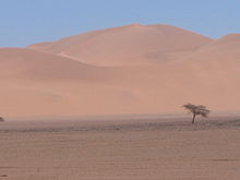
While annual rainfall of less than 50 mm is expected in the desert environment, it adds up to 400 mm in the highlands. Dew, fog, haze and rare rain, especially on the seaward north and north-east side, created a mountain or fog oasis with the consequence of a biodiversity hotspot. The center of the comparatively water-rich region is represented by the 1437 m high Gebel Elba ( 22 ° 10 ′ 33 ″ N , 36 ° 21 ′ 52 ″ E ). From here numerous wadis cut through the granite mountains in all directions, the largest of which are Wadi Akwamtra, Wadi Aideib and Wadi Serimtai. The main wadi Yahameib, with its tributaries Wadi Akaw and Wadi Kansisrob, drains to the north.
biodiversity
plants
So far 485 plant species from 51 families have been counted. Trees, bushes and shrubs form the only natural forest in Egypt. Ferns , mosses and succulents predominate in the higher fog zones .
Biscutella elbensis is endemic here. With its root system, it can gain a foothold in rock, rubble and rubble, like its European counterpart smooth-eyed pods ( Biscutella laevigata ). Both belong to the cruciferous family ( Brassicaceae ), like the real rose of Jericho .
Mountain rivers and mountain swathes are relatively densely overgrown and are dominated by the umbrella acacia ( Acacia tortilis ). In addition, there is the white flamboyant ( Delonix elata ), also Aerva javanica syn. persica , a perennial, semi-shrubby plant that prefers sandy subsoil and is popular with goats and sheep, the thorn bush Euphorbia cuneata , which belongs to the large group of milkweed plants ( Euphorbiaceae ), and many more.
Animals
There is no parallel to the many animal species in other desert areas of Egypt. 23 mammal , 41 bird and 22 reptile species , but only one amphibian have been inventoried so far.
The mammals observed include the Dama gazelle , the Dorcas gazelle and the African wild ass . According to statements of UNESCO , were Mendes , saber and hartebeest sighted.
Some of the bird species are of tropical-African origin and find their northernmost limit in the area of the national park. There are sparse observations of the African ostrich , eared or lobed, bearded and Egyptian vulture , the Cape and Bonelli's eagle .
Bedouin
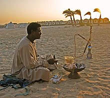
In and around the national park are the Bedouin tribes of the Bedscha including the Ababde , Bisharin and Hadendoa as well as Raschaida . With their cultural peculiarities, they should be integrated into the nature reserve project.
The dry period of 1984–86 was a disaster for all Bedouins living here. It is estimated that they lost 95% of their herds during this time. After the heavy rainy year in 1996, another drought set in, which has now lasted for more than ten years. Overall, the average amount of precipitation in the area seems to be falling steadily. The lack of water has forced many of them to move to the nearby coastal city of Abu Ramad .
The Bedscha are often associated with the ancient Blemmyans . According to the oral tradition of the Bedscha, Mount Elba is their place of origin. The tribal elder is currently Sheikh Hasan.
The Arabized Ababda Bedouins form the second largest group. They are viewed as a subgroup of the Bedscha, live mainly in the northern part and are considered sedentary to semi-nomadic.
The Bisharin Bedouins are non-Arab semi-nomads who are related to tribes in Sudan and Ethiopia. They are known to breed good, fast camels. They also live from trade in goats and sheep and from charcoal production. At the markets in southern Egypt they exchange their goods for corn, grain, beans, dates, sugar, linen, leather, sabers and other utensils. They have an extraordinary ability to read tracks - they can identify the tracks of individual camels or sheep - and are often recruited for biological expeditions.
Rashaida Bedouins are not originally at home here, but first settled mainly on the coastal plains from the Arabian Peninsula in the 19th century .
The Hadendoa Bedouins were known to be belligerent until the 20th century. They used to be known as Fuzzy Wuzzys , as they piled their long frizzy hair into a bushy afro hairstyle with the help of butter .
Individual evidence
- ↑ http://www.egyptchm.info/?wpfb_dl=186
- ^ Sudan's disputed borders - trouble brewing? In: martinplaut . May 3, 2016 ( wordpress.com [accessed March 28, 2018]).
- ^ Mountain Chains. whc.unesco.org on ecology
- ↑ www.birdlife.org on the bird species
Web links
- Klaus Polak: Wadi el Gamal to the Sudanese border. Tourist information
- Map with borders of Egyptian national parks and protected areas
Coordinates: 22 ° 11 ' N , 36 ° 21' E


