Esna
| Esna in hieroglyphics | ||||||||
|---|---|---|---|---|---|---|---|---|
Junyt Jwnyt |
||||||||
Senate / Senet Sn3t / Snt |
||||||||
Sekhet-Chenmu TBI ẖnmw fields of Khnum |
||||||||
| Greek | Λατόπολις Latópolis | |||||||
| Coptic | Sne | |||||||
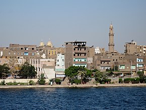
| City view of the Nile side from Esna | ||||||||
Esna or Isna ( Arabic إسنا, DMG Isnā ; Coptic Sne ) is a city on the western bank of the Nile in Upper Egypt , about 55 kilometers south of Luxor and 135 kilometers north of Aswan . The city is connected to the eastern side of the Nile by a Nile dam , over which a road runs. Esna has over 70,000 inhabitants (calculation: 2010) and is a center of the Coptic faith. Since the Nile perch (Lates Niloticus) was revered here and buried in necropolises , the Greeks named the place Latopolis .
The area around Esna is still today characterized by agriculture , especially the cultivation of cotton . Handicrafts are an important line of business in the city. Esna is known for the preserved pronaos of the Khnum temple from Roman times, which stands in the middle of the old town nine meters below today's street level.
Esna had different names in ancient times. Initially known under the ancient Egyptian name forms Iunyt , Senat / Senet or Sechet-Chenmu , the place was called Latópolis ( Greek Λατόπολις) or Láton Pólis (Λάτων Πόλις) in Ptolemaic times . In the Roman era the name was shortened to Latin Lato . The Coptic name of the city Sne was derived from the ancient Egyptian name and is preserved in the Arabic Isnā .
location
Location in Egypt |
Esna is located in the southern part of Egypt on the Nile, 145 kilometers north of Lake Nasser in the middle of a fertile plain on both sides of the river, but mainly northwest of the city. It has a north-south extension of about 27 kilometers and an east-west extension of up to 13 kilometers. Much of the plain is artificially irrigated by the water of the Nile and used for agriculture. This is followed by the Arabian Desert in the east and the Libyan Desert in the west .
The place administratively belongs to the governorate al-Uqsur (Luxor). The Sudanese border in the south is around 350 kilometers away, and the Red Sea in the northeast is 195 kilometers away. Esna is connected to Aswan and Luxor along the Nile by a railway line that runs along the eastern bank of the river. The station is about 800 meters from the Nile and can be reached via the street of the southern Nile dam. The city center is just over a kilometer south of this dam.
Esna is connected to the governorate capital Luxor by a road that runs north on the east bank of the Nile. The closest airport, Luxor International, is in Luxor . However, the most important traffic artery for Esna is the Nile, on which the river cruise ships, important for tourism, operate from Luxor to Aswan and the freight traffic to Lower Egypt is handled. The landing stage for the cruise ships operating on the Nile is at the height of the city center and south of it at the souk ( market ) of Esna, from where the remains of the Khnum temple can be easily reached on foot.
history
The exposed pronaos of the Khnum Temple in Esna is located in the middle of the city center, but nine meters below today's ground level. In addition to the ram-headed main god Khnum , his wife Menhit , the city goddess Nebet-Uu and the gods Heka and Neith were worshiped in the temple . Construction began in the Ptolemaic period on the ruins of an early 18th Dynasty sanctuary . The remaining vestibule was completed in Roman times . Thus the names of the emperors Claudius and Vespasian are mentioned on the front of the temple. The pronaos of Esna largely resembles the vestibule of the Temple of Hathor in Dendera .
The ceiling of the pronaos is supported by 24 columns adorned with flower capitals . It shows ancient Egyptian astronomical representations above the aisles and two rows of flying vultures above the central nave . All walls are decorated inside and outside with reliefs . They show representations of the emperors Commodus , Domitian , Titus and Trajan with the Egyptian gods.
The quay on the Nile, which also dates back to Roman times, is still partially preserved. He carries cartouches of the emperor Marcus Aurelius . The remains of a nilometer (instrument for measuring the Nile level) can still be seen. Around 4 km southwest on the right bank of the Nile, two rock steles were discovered near the village of Sarnich . They are dated to the beginning of the reign of Amenhotep IV (Akhenaten).

The first scientific excavations at the Khnum Temple, buried by Nile mud and building rubble for several centuries, were carried out in the middle of the 19th century by Auguste Mariette . Before that, French soldiers had uncovered parts of the temple complex in the course of the conquest of Egypt by Napoleon Bonaparte . The urban area had previously expanded beyond the temple grounds. After it was uncovered, the interior of the portico of the pronaos was partially used as a cotton warehouse.
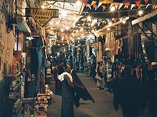
In order to irrigate large areas of the fields downstream and thus enable the cultivation of cotton, the Esna weir was built in 1908 under British rule . In the 1990s, another barrage was built north of it. Both also serve as Nile crossings for road traffic. Due to its location around the sight of the Khnum Temple, the souk of Esna has recently developed into a market tailored to tourism .
sons and daughters of the town
- Pachomios the Elder (around 292 / 298–346), Christian saint, Egyptian monk and the founder of the first Christian monasteries
literature
- Dieter Kurth : Esna. In: Kathryn A. Bard (Ed.): Encyclopedia of the Archeology of Ancient Egypt. Routledge, London 1999, ISBN 0-415-18589-0 , pp. 294-95.
- Latopolis. In: Hans Bonnet : Lexicon of the Egyptian religious history. 3rd unchanged edition. Nikol, Hamburg 2000, ISBN 3-937872-08-6 , p. 416f.
- Alexandra von Lieven : The sky over Esna. A case study on religious astronomy in Egypt using the example of the cosmological ceiling and architrave inscriptions in the temple of Esna (= Ägyptologische Abhandlungen. Vol. 64). Harrassowitz, Wiesbaden 2000, ISBN 3-447-04324-5 (Also: Master's thesis, University of Tübingen, 1998).
Web links
Individual evidence
- ↑ ( Page no longer available , search in web archives: World Gazetteer - Egypt: The most important places with statistics on their population )
- ↑ Giovanna Magi: A trip on the Nile - The temples of Nubia, Esna - Edfu - Kom Ombo. Casa Editrice Bonechi, Florence 2008, ISBN 978-88-7009-246-2 , p. 6.
- ↑ Latopolis (www.trismegistos.org)
- ↑ ESNA: Khnum-Tempel (www.roland-harder.de) .
- ^ William Willcocks, James Ireland Craig: Egyptian Irrigation . Volume II. 3rd edition. Spon, London / New York 1913. pp. 668 f
Coordinates: 25 ° 18 ' N , 32 ° 33' E


