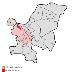
Etten (Oude IJsselstreek)
| province |
|
| local community |
|
|
Area - land - water |
10.97 km 2 10.82 km 2 0.15 km 2 |
| Residents | 1,895 (Jan. 1, 2017) |
| Coordinates | 51 ° 55 ' N , 6 ° 20' E |
| Important traffic route |
|
| prefix | 0315 |
| Postcodes | 7007, 7045-7046, 7048, 7061, 7071, 7075-7076 |
| Location of Etten in the municipality of Oude IJsselstreek | |
Etten is a Dutch village in the municipality of Oude IJsselstreek in the province of Gelderland . It is located southeast of Doetinchem on the Alte Issel and has 1,895 inhabitants.
Until 1960 it was dominated by agriculture and today still has some rural hamlets. The Etten men's choir is to some extent known nationwide. Every year there is a big Easter bonfire and in September there is a fair. The local football club is VV Etten .
In Etten there is a Roman Catholic and a Protestant church and a restored windmill, which has been a listed building since 2010.
Web links
Commons : Etten - collection of images, videos and audio files
Individual evidence
- ↑ a b Kerncijfers wijken en buurten 2017 Centraal Bureau voor de Statistiek , accessed on July 20, 2018 (Dutch)


