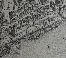
Drive gate
The Fahrtor was a city gate of the city fortifications of Frankfurt am Main . As the most important main side gate it joined the center of the historic city center , the Römerberg , with the out-of-town wall port on the river Main. It was built between 1456 and 1460 and demolished in 1840.
location
The Fahrtor, which has been preserved as a street name to this day, was located south of the Römerberg and the intersection with Saalgasse and Alte Mainzer Gasse , near the Alte Nikolaikirche . The listed Haus Wertheim forms the west side of the short Torstrasse . It is the only house in its original condition with exposed half-timbering in Frankfurt's old town that survived the air raids on Frankfurt am Main almost unscathed. The Saalhof is opposite on the east side of the street . The rent tower was part of the ensemble of Fahrtor and Saalhof . Opposite the Fahrtor on the Mainkai has been the northern bridgehead of the Eiserner Steg since 1869 .
The drive gate gave its name to the Frankfurt (Main) drive gate of the Frankfurt connecting railway in the area directly in front of the gate and the north head of the Eiserner Steg. At this point there is now a stopping point in the museum operation of the Frankfurt Historical Railway, which is offered several weekends a year .
history
The city expansion approved in 1333 made it necessary to build a new city wall, which should also protect access from the banks of the Main. The construction work, which Frankfurt citizens were obliged to do, dragged on until the 15th century. While the new land wall received only a few, heavily fortified gates, several smaller gates were built between the city and the unprotected port facilities on the banks of the Main. Only the important gates at the southern ends of the inner-city north-south main streets were given a more elaborate design, namely the Leonhardstor at the end of the Kornmarkt- Buchgasse street, the Old Town Bridge Tower at the transition from the Fahrgasse to the Old Bridge and the Fahrtor, where the relation Neue Kräme -Römerberg meets the banks of the Main.
The Fahrtor was first mentioned in the middle of the 14th century in a chronicle of Baldemar von Petterweil , canon of St. Bartholomew . However, like the neighboring Leonhardstor, it only got its final shape from 1456 to 1460 by Eberhard Friedberger , who was in the municipal service as a foreman from 1435 to 1456 . The massive basement with the passage, which is also suitable for wagons, rose above a rectangular floor plan of 45 ½ by 23 ½ feet. The opening towards the Main formed a pointed arch , and towards the Römerberg a round arch . The interiors served as storage and, during the Frankfurt trade fair, also as exhibition and sales rooms. Two protruding round arch friezes formed the upper end of the basement. There was an oriel decorated with rich tracery , the imperial and city arms, above the gate opening on the mains side . Council and court meetings were held on the upper floors; in the 19th century they also served as the official residence of the tax authorities and, most recently, as detention cells.
While the land wall, which was expanded to include baroque bastions in the 17th century, was laid down at the beginning of the 19th century and replaced by ramparts , the main gates were initially retained. Fahrtor and Leonhardstor were only demolished in 1840, when the Mainkai was re-routed as a new embankment road several meters above the previous level for reasons of flood protection and the bases of the adjacent buildings sank below the new street level. The classicist guardhouse also disappeared with the drive gate. In his place, city architect Henrich built a new guard and customs building, in whose facade he integrated the bay window of the drive gate. The high water marks were transferred to the pension tower. The building still exists today and was renovated at the beginning of the 21st century. Its neighbors to the north were the Roter Krebs house (Am Fahrtor 4) and Freudenberg / Brabant (Am Fahrtor 6) on the corner of Saalgasse. Both houses were demolished in 1970 for the new building of the historical museum .
See also
Web links
literature
- Fried Lübbecke , The Face of the City. According to Frankfurt's plans by Faber, Merian and Delkeskamp. 1552-1864. Frankfurt am Main 1952, Waldemar Kramer publishing house,
- State Office for Monument Preservation Hessen (Hrsg.): Fahrtor In: DenkXweb, online edition of cultural monuments in Hessen
Coordinates: 50 ° 6 ′ 33.7 " N , 8 ° 40 ′ 55.7" E

