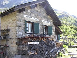
Fergenhütte
| Fergenhütte SAC hut |
||
|---|---|---|
| location | above the Klosters Alps; Graubünden , Switzerland ; Valley location: Klosters-Serneus | |
| Mountain range | Silvretta | |
| Geographical location: | 792 564 / 193 965 | |
| Altitude | 2145 m above sea level M. | |
|
|
||
| builder | SAC Prättigau | |
| owner | SAC - Prättigau section | |
| Built | 1920, rebuilt in 1923 | |
| Construction type | hut | |
| Usual opening times | year-round self-catering hut | |
| accommodation | 21 beds | |
| Winter room | 21 bearings | |
| Web link | Web presence of the section | |
| Hut directory | SAC | |
The Fergenhütte is a mountain hut belonging to the Swiss Alpine Club (SAC), Prättigau section , in the Swiss canton of Graubünden .
The self-catering hut is at the far end of the Prättigau , east of Klosters -Monbiel, above the Klosters Alps and below the southern slope of the Fergenkegel at an altitude of 2145 m above sea level. M. , in a panoramic location with a view of the Prättigau and Silvretta region .
The hut offers 21 beds all year round, is open all year round and not manned. It has its own power supply with a water turbine for lighting.
history
The first Fergenhütte was built in 1920 and destroyed by an avalanche in the spring of 1922. In 1923, thanks to the efforts of the club members at the time, a new building was built. In 1971, 1985 and 1994 minor extensions and renovations were carried out.
The hut, which is not manned, has cooking facilities (wood stove) and a “hut bar” with drinks and snacks for self-service. Duvets and pillows are available in the bedroom. The fountain in front of the hut serves as a washing facility. The log cabin toilet is right next to the hut.
Access and approaches
Access by car or local bus is via Monbielerstrasse or Doggilochstrasse to Aeuja and to the chargeable parking lot of the Walser settlement Monbiel 1291 m above sea level. M. From there, the road along the valley to the point 1,332 meters above sea level. M. Now you go left on a good road to Schwendi and over the Alpboden into the Pardenner forest. A beautiful forest path leads in a moderate incline in large bends to Pt. 1753 1753 m above sea level. M. (tree line). The footpath initially climbs a little steeply, crosses the slope to the east and leads to the Fergenhütte.
The hut can be reached on foot from Monbiel in 2 to 2½ hours from the Swiss side . The normal ascent (difficulty T2) can be done with normal hiking boots. The hut trail is marked from Monbiel with signs for the Bündner Wanderwege (BAW) . As an alternative approach (difficulty T2), the path a little further to the east via Obergarfiun, Obersäss can be taken.
Hiking and climbing tours
The hut is suitable as a starting point for circular hikes and tours with transitions to the surrounding huts: Seetalhütte SAC, Silvrettahütte SAC, Tübinger Hütte DAV, Saarbrückner Hütte DAV.
The alpine climbing route on the Fergenkegel ( 2844 m above sea level ) is a classic that offers various routes in the IV level of difficulty (key point in the fifth level of difficulty).
literature
- Peter Gujan, Gian Andrea Hartmann: Silvretta / Unterengadin / Münstertal: Davos to Müstair. SAC Club Guide Bündner Alpen 8/9: SAC-Verlag Schweizer Alpen-Club, 2010, ISBN 978-3859023093


