
Silvretta hut
| Silvrettahütte SAC hut |
||
|---|---|---|
 |
||
| location | below the Silvretta Glacier ; Graubünden , Switzerland ; Valley location: Klosters | |
| Mountain range | Silvretta | |
| Geographical location: | 798 464 / 192 559 | |
| Altitude | 2341 m above sea level M. | |
|
||
| builder | SAC Rätia | |
| owner | SAC - St. Gallen section | |
| Built | 1865, new building 1890, remodeling summer 2011 | |
| Construction type | hut | |
| Usual opening times | Mid-June to mid-October, mid-February to early May | |
| accommodation | 69 beds | |
| Winter room | 12 bearings | |
| Web link | silvrettahuette.ch | |
| Hut directory | ÖAV DAV SAC | |

The Silvrettahütte is a mountain hut belonging to the Swiss Alpine Club (SAC), St. Gallen section , in the Swiss canton of Graubünden . It consists of two buildings and is located east of Klosters at an altitude of 2341 m above sea level. M. and below the Silvretta Glacier , in a panoramic position with a view of the Prättigau .
It offers 69 beds (12 of them in the winter room) and is managed in the summer season from mid-June to mid-October and in the winter season from mid-February to early May. The hut has its own power supply by means of a water turbine.
history
The first Silvretta hut was built in 1865. In 1887 it was taken over by SAC Davos from the Rätia section . Because of poor building ground (moraine) it had to be rebuilt in 1890. In 1904 an inn was built next to it. Both became the property of the St. Gallen Section of the SAC in 1910. The paneled (Switzerland .; dt. Paneled) stone pine room with hand-carved armchairs from 1916 is reminiscent of that time. The Silvrettahütte is located around 1½ km from the Austrian border on Swiss soil.
Approaches
It can be reached from the Swiss side from Klosters-Monbiel in 4½ hours; from Austria from Bielerhöhe - Klostertal - Rote Furka in 3½ hours.
Neighboring huts
Tours
The hut is suitable as a starting point for circular hikes and summit destinations, glacier and ski tours and numerous climbing tours with crossings as well as a stage location for diverse hikes with crossings (Furggen and glacier). In total there are around 100 tour options and summit destinations. It is also a varied (glacier trail, climbing garden), ideal place for family holidays in the mountains.
Glacier nature trail
The Silvretta Glacier Educational Path is a guided hiking trail in the forefield of the Silvretta glacier , which begins at the Silvrettahütte. It is provided with 15 information boards that give hikers tips on phenomena that they can observe. Each board provides information about a topic to be observed from glaciology , biology or geography. The nature trail is marked with yellow-blue markings that show you the way. The nature trail is just over four kilometers long and overcomes a difference in altitude of around 230 meters. The path usually runs along well-marked paths and is safe for hikers to walk. Part of it runs over a block pile, for which sturdy footwear is necessary. A danger sign warns of the block dump. In the course of the path you have a good view of the glacier. The path also passes close to the glacier gate. In contrast to the glacier nature trail on the Morteratsch Glacier , the most popular Swiss glacier trail, there is much less tourism on this nature trail and it is more difficult to get to.

course 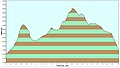
Elevation profile 
Table 1
" Moraines as contemporary witnesses "


Flora and fauna
On the nature trail you have the opportunity to discover ptarmigan , ibex, marmots , glacier fleas and countless insects. There is also a lot to see for flower lovers. Gentians can be found among others .
hazards
The Silvretta Glacier should only be crossed with ropes ( danger of crevasses ).
cards
- Alpine Club Card 26 Silvretta Group (1: 25,000)
Web links
- Panorama from the Silvrettahütte
- SF bi de Lüt - (1) Hut stories on the Swiss television website
- Forum for summer mountain tours with current tour reports
- Homepage of the Swiss hut keepers