
Talas area
|
Talas region Талас облусу |
|||
|
|||
| State : |
|
||
| Capital : | Talas (Kyrgyzstan) | ||
| Biggest cities: | • Talas • Maimak |
||
| Area : | 11,400 km² | ||
| Residents : | 219,000 (2009) | ||
| Population density : | 19 inhabitants per km² | ||
| License plate : | 07 | ||
| ISO 3166-2 : | KG-T | ||
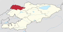  Location of the Talas area in Kyrgyzstan |
|||


The Talas region ( Kyrgyz Талас облусу Talas oblussu ; Russian Таласская область Talasskaja oblast ) is one of 7 regions in Kyrgyzstan and has a population of around 219,000 people. It is located in the northwest and borders on Kazakhstan in the northwest , Uzbekistan in the west , the Jalalabat region in the south and the Chüi region in the east . The capital is Talas .
geography
The Talas area is located in the north of Kyrgyzstan in Central Asia. It extends over an area of 11,400 km² and is therefore roughly the size of the Austrian state of Upper Austria . The Talas River of the same name flows through the center of the area, which essentially occupies the Talas Valley. This forms a triangle that has its highest point in the east, where Talas-Alatau and Kyrgyz Alatau meet. In the north the valley widens and borders the Turan lowlands .
The area lies in the temperate climate zone, whereby the relief causes a continental character. The mean January temperatures are between −6 and −14 ° C and the mean July temperatures between 15 and 25 ° C. There are between 157 and 163 frost-free days per year. The precipitation decreases from west to east and is between 300 and 400 mm annually. Most of the precipitation falls in April and May, on the mountains in May and June. The summers are dry; There is usually a permanent snow cover from December.
The most important river in the area is the Talas , which is formed by the confluence of the Uchkoschoi and Karakol headwaters , flows westward and dries up in the Mujunkum desert . Important tributaries of the Talas are the Urmaral , Kümüschtak , Kenkol , Karabuura , Beschtasch , Nyldy and Kalba . There are few lakes in the Talas area; the largest lake was created by a landslide on the Beshtash river. About 164.7 km² are covered by glaciers , of which there are 281 in the Talas area. The largest are Wokrug Sweta with 6.8 km² and Manas with 6.4 km².
population
The Talas had a population of 199,900 people in the 1999 census and of 219,000 in 2009 with a population density of 19 people per km², ranking sixth in Kyrgyzstan. Most of the people (83.7%) live in rural areas. The largest city in the area is the capital Talas .
Administrative division
The Talas area is divided into four districts ( Rajons ). The following districts are in Talas:
| District structure ( Rajons ) Talas area |
|||
|---|---|---|---|
| District ( Rajon ) |
administrative seat |
location | |
| Bakaiata | Bakaiata |

|
|
| Karabuura | Kyzyladyr |

|
|
| Manas | Pokrovka |

|
|
| Talas | Manas |

|
|
Web links
Individual evidence
- ↑ a b c d Осмон Ибраимов, Осмонакун Ибраимов: Кыргызстан: энциклопедия . Центр государственного языка и энциклопедии, Bishkek 2001, ISBN 5-89750-129-7 , p. 521 (Russian).
Coordinates: 42 ° 30 ' N , 72 ° 30' E