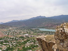
Jalalabat region
|
Jalalabat region Жалал-Абад облусу |
|||
|
|||
| State : |
|
||
| Capital : | Jalalabat | ||
| Biggest cities: | • Tashkömür • Mailuusuu • Karaköl |
||
| Area : | 32,418 km² | ||
| Residents : | 1,009,889 (2009) | ||
| Population density : | 31 inhabitants per km² | ||
| License plate : | 04 | ||
| ISO 3166-2 : | KG-J | ||
|
Location of the Jalalabat region in Kyrgyzstan |
|||
The area Jalalabat ( kirghiz Жалал-Абад облусу Jalal-Abad oblussu ; Russian Джалал-Абадская область Jalal-Abadskaja oblast ) is one of 7 management areas ( oblast are similar in composition and structure German Federal States) Kyrgyzstan in Central Asia .
It is located in the west of the country and borders on Talas and Tschüi in the north, Naryn in the east and Osh and Uzbekistan in the south . The area has an area of 32,418 km² and approx. 1,010,000 inhabitants. The capital and largest city of the area with 97,172 inhabitants is Jalalabat .
geography


The Jalalabat area is very mountainous, only a small part in the south on the border with Uzbekistan is part of the fertile Ferghana Valley . In the area, the main traffic axis M41 runs between north and south from the Kyrgyz capital Bishkek to Osh through the mountains of the Kyrgyz Alatau (crossing the Töö Pass , 3586 m ) and the Talas Alatau ( Alabel Pass , 3184 m ) . The Toktogul Dam is the largest in Kyrgyzstan along the route .
Jalalabat has numerous mountain lakes, mineral springs and nut forests. The walnut forests near Arslanbob are of particular importance . With an area of 30,000 hectares, they are the largest in the world. Recognition as a UNESCO World Heritage Site is sought. The IUCN has designated numerous internationally recognized protected areas due to the remoteness and unspoilt nature of the mountain regions in Jalalabat. The strictest protection regulations (IUCN category Ia ) apply to the Sary Chelek Biosphere Reserve, the Besh Aral Nature Reserve in the far west and the Padyschata Nature Reserve . The Saimaluu-Tash National Park is located in the Toguz- Toro district . There are also numerous other lower-level protection categories in the Jalalabat area.
Due to the mountainous character of the region, agriculture is limited to the flat areas of the Ferghana Valley in the south. Wheat, fruits, nuts, tobacco, various vegetables and maize are grown here, as well as mulberries for making silk . There is a small textile industry and a few hydroelectric power stations . During the Soviet era there was a significant extraction of minerals, metals, natural gas, oil and coal, but most of the operations disappeared after Kyrgyzstan gained independence. Today there is only a small industry in the Jalalabat area, mainly around the city of Kochkor-Ata . Tourism is an up-and-coming branch of the economy, but (with the exception of Arslanbob) this is not yet very pronounced due to a lack of infrastructure.
population
| Population development of the Jalalabat region (source :) |
||
|---|---|---|
| date | Residents | ±% |
| 1970 | 481,691 | - |
| 1979 | 586,602 | + 21.8% |
| 1989 | 743.279 | + 26.7% |
| 1999 | 869.259 | + 16.9% |
| 2009 | 1,009,889 | + 16.2% |
There are five cities, eight urban-type settlements and 415 villages in the Jalalabat area . The 2009 Kyrgyz census found the area to have a population of 1,009,889. The largest cities are Jalalabad (97,172 inhabitants), Taschkömür (34,756 inhabitants), Mailuu-Suu (22,853 inhabitants) and Karakol (22,502 inhabitants).
The ethnic composition of the Jalalabat population is very homogeneous. There are two predominant ethnic groups, with the Kyrgyz making up the largest proportion (71.8%) , followed by the Uzbeks with 24.8%. All other ethnic groups (including Russians , Turks , Tajiks ) each make up less than 1%.
Administrative division
The Jalalabat area is divided into eight districts ( Rajons ). The following districts are in Jalalabat:
| Divisions ( Rajons ) Jalalabat region |
||||
|---|---|---|---|---|
| District ( Rajon ) |
administrative seat |
Pop. | Area (in km²) |
location |
| Aksy | Notches | 113.010 | 4,578 |

|
| Ala-Buka | Ala-Buka | 87,460 | 2,976 |

|
| Bazaar orgon | Bazaar orgon | 142,951 | 1.965 |

|
| Nooken | Massy | 117.055 | 2,336 |

|
| Susak | Susak | 241.198 | 3,019 |

|
| Toguz Toro | Kazarman | 22,136 | 3.816 |

|
| Toktogul | Toktogul | 86,306 | 7,815 |

|
| Chatkal | Kanysch-Kyja | 22,490 | 4,608 |

|
Web links
Individual evidence
- ^ Schmidt, M. (2005): Utilization and management changes in South Kyrgyzstan's mountain forests . In: Journal of Mountain Science , Vol. 2, No. 2: p. 93. Abstract: doi : 10.1007 / BF02918325
- ↑ a b c d Population and Housing Census 2009. Book 3 (in tables). Provinces of Kyrgyzstan: Jalal-Abad Province (Перепись населения и жилищного фонда Кыргызской Республики) 2009. Книга 3 (в таблицах). Регионы Кыргызстана: Джалал-Абадская область ( Memento from August 10, 2011 in the Internet Archive ) (PDF; 5.3 MB), Bishkek: National Committee on Statistics, 2010 (Russian)
Coordinates: 41 ° 15 ' N , 72 ° 15' E


