Gershausen (Heimarshausen)
Coordinates: 51 ° 10 ′ 37 ″ N , 9 ° 11 ′ 2 ″ E
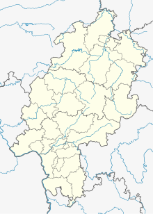
Gershausen is a Dorfwüstung in today's district of Heimarshausen , a district of Naumburg in northern Hesse Kassel district .
Geographical location
The place was about 1.5 km west-southwest of Heimarshausen, not far from the historical border between the Landgraviate of Hesse and the County of Waldeck , at an altitude of 364 m at a source at the north foot of the sand dome ( 352.9 m ) . In the immediate vicinity there is now a municipal water tank within the forest edge. The level map of the Electorate of Hesse from 1840 to 1861 shows the field name "Gershausen" there.
history
Almost nothing is known about the history of the place, not even when it was abandoned.
- Possibly the first recorded mention in 1253 as the official Count Berthold von Felsberg all his equity and fiefdoms , including those in Gershausen, the convent Breitenau for an everlasting Seelgerät handed, may or may not be on this site relate, because at that At that time there were several places in North Hesse whose names appear in documents like this or something like that.
- Even with the only other mention, there are doubts as to whether it applies here. On October 3, 1353, Kuno II von Falkenstein , provost of the Mainz cathedral chapter and during the Mainz schism (1346 to 1353) administrator of the Mainz archbishopric , the knight Reinhard von Dalwigk , allowed the desolation of Gershusen and the court for 50 pounds Heller from Hermann Hund , to which she had pledged the archbishopric - but this is more likely to refer to Gershausen near Altenstädt, which belongs to the Electoral Mainz office of Naumburg .
Footnotes
- ^ Electorate of Hesse 1840-1861 - 30. Fritzlar, in: Historical maps
- ↑ HStAM Fund, Document 16, No. 16
- ↑ A desert in the district of Waltersbrück in the Schwalm-Eder district is probably the place in question. See Gerzhausen, Schwalm-Eder-Kreis. Historical local dictionary for Hessen. In: Landesgeschichtliches Informationssystem Hessen (LAGIS) ..
- ↑ 240 hellers = 1 pound.
- ↑ See also Altenstädt - Our story .
literature
- Georg Landau : Historical-topographical description of the desolate localities in the Electorate of Hesse and in the grand-ducal Hessian parts of Hessengaue, Oberlahngaue and Ittergaue (= journal of the Association for Hessian History and Regional Studies. Supplement 7, ZDB -ID 200295-4 ). Theodor Fischer, Kassel 1858, p. 153 .
- Heinrich Reimer (Hrsg.): Historical local lexicon for Kurhessen (publications of the historical commission for Hessen). Elwert, Marburg, 1974, p. 167.
Web links
- Gershausen, district of Kassel. Historical local dictionary for Hessen. In: Landesgeschichtliches Informationssystem Hessen (LAGIS).
