Gleisenhof (Neunkirchen am Brand)
|
Gleisenhof
Market Neunkirchen am Brand
Coordinates: 49 ° 38 ′ 20 ″ N , 11 ° 10 ′ 18 ″ E
|
|
|---|---|
| Height : | 468 m above sea level NHN |
| Residents : | 36 (Jan 2019) |
| Postal code : | 91077 |
| Area code : | 09192 |
|
The Neunkirchen district of Gleisenhof
|
|
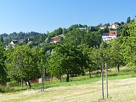
Gleisenhof is a Franconian village belonging to the market Neunkirchen am Brand , which is located in the north-west of the natural landscape unit of the Graefenberg area alb .
geography
The village is one of eleven officially named districts of the market Neunkirchen am Brand in the south-western part of Upper Franconia . Gleisenhof is located about four kilometers northeast of Neunkirchen and is at an altitude of 468 m above sea level. NHN . The village is located on the southern slope of the Hetzleser mountain and with its highest parts of the settlement reaches up to the southern edge of the summit plateau.
history
Up until the end of the 18th century, Gleisenhof had been subject to the high jurisdiction of the Neunkirchen Centamt , which was part of the Bamberg monastery, but this legal system was restricted by the limited cents that went to the Barons of Künßberg-Ermreuth . The manorial rule over the place, which at that time only consisted of a sheep farm, was also owned by this noble family, as was the rulership of the village and community . At the beginning of the 19th century, the place came into the possession of the Kingdom of Bavaria .
Due to the administrative reforms carried out in the Kingdom of Bavaria at the beginning of the 19th century, Gleisenhof became part of the independent rural community of Ermreuth with the second municipal edict in 1818 , which also included the Saarmühle desert . In the course of the communal territorial reform carried out in Bavaria in the 1970s , Gleisenhof was incorporated into the Neunkirchen market together with the entire municipality of Ermreuth on January 1, 1972. At the beginning of 2019 the village had 39 inhabitants.
traffic
The connection to the public road network was only established in 1996. It is realized by a communal road that branches off from the district road FO 28 in Ermreuth and ends as a dead end after passing through the village on the southern edge of the Hetzleser Berg plateau. From there, a non-asphalt dirt road forms the access path to the Hetzleser Berg airfield , which is used for sailing.
literature
- Ingomar Bog: Forchheim . In: Historical Atlas of Bavaria . Commission for Bavarian State History, Munich 1955.
- Gertrud Diepolder : Bavarian History Atlas . Ed .: Max Spindler . Bayerischer Schulbuch Verlag, Munich 1969, ISBN 3-7627-0723-5 .
- Sigmund Benker, Andreas Kraus (Ed.): History of Franconia up to the end of the 18th century . 3. Edition. Beck, Munich 1997, ISBN 3-406-39451-5 .
- Federal Statistical Office (Hrsg.): Historical municipality register for the Federal Republic of Germany. Name, border and key number changes in municipalities, counties and administrative districts from May 27, 1970 to December 31, 1982 . W. Kohlhammer, Stuttgart / Mainz 1983, ISBN 3-17-003263-1 .
Web links
- Bavarian authorities guide for Gleisenhof , accessed on July 7, 2019
- Gleisenhof in the BayernAtlas , accessed on July 7, 2019
- Gleisenhof on a historical map , accessed on July 7, 2019
Individual evidence
- ↑ a b Bavarian State Office for Statistics and Data Processing (Ed.): Official local directory for Bavaria, territorial status: May 25, 1987 . Issue 450 of the articles on Bavaria's statistics. Munich November 1991, DNB 94240937X , p. 303 ( digitized version ). Retrieved July 7, 2019
- ^ Gleisenhof in the local database of the Bavarian State Library Online . Bayerische Staatsbibliothek, accessed on July 7, 2019.
- ↑ Geographical location of Gleisenhof in the BayernAtlas , accessed on July 7, 2019
- ^ Ingomar Bog: Forchheim . S. 54 .
- ^ Ingomar Bog: Forchheim . S. 115 .
- ^ Federal Statistical Office (ed.): Historical municipality directory for the Federal Republic of Germany. Name, border and key number changes in municipalities, counties and administrative districts from May 27, 1970 to December 31, 1982 . W. Kohlhammer, Stuttgart / Mainz 1983, ISBN 3-17-003263-1 , p. 682 .
- ^ History of Gleisenhof on the Neunkirchen website , accessed on July 7, 2019

