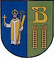
Gmina Bobowo
| Gmina Bobowo | ||
|---|---|---|

|
|
|
| Basic data | ||
| State : | Poland | |
| Voivodeship : | Pomerania | |
| Powiat : | Starogardzki | |
| Geographic location : | 53 ° 53 ' N , 18 ° 33' E | |
| Residents : | see Gmina | |
| Postal code : | 83-212 | |
| Telephone code : | (+48) 58 | |
| License plate : | GST | |
| Economy and Transport | ||
| Rail route : | Starogard Gdański - Skórcz (closed) | |
| Gmina | ||
| Gminatype: | Rural community | |
| Gmina structure: | 6 school offices | |
| Surface: | 51.67 km² | |
| Residents: | 3188 (Jun. 30, 2019) |
|
| Population density : | 62 inhabitants / km² | |
| Community number ( GUS ): | 2213042 | |
| administration | ||
| Community leader : | Sylwester Patrzykąt | |
| Address: | ul.Gdańska 12 83-212 Bobowo |
|
| Website : | www.bobowo.gmina.pl | |
The Gmina Bobowo is a rural municipality in Poland and is located in the powiat Starogardzki of the Pomeranian Voivodeship . Its seat is in the village of Bobowo ( German Bobau ).
structure
Six villages (German names until 1945) with a Schulzenamt belong to the rural community of Bobowo :
- Bobowo ( Bobau / 1939–42 Dietersfelde )
- Grabowiec ( Grabowitz / 1939–42 Buchenwalde , 1942–45 Grabwitz )
- Grabowo Bobowskie ( Grabau / 1939–42 Buchenau )
- Jabłówko ( Klein Jablau / 1942-45 small fork )
- Smoląg ( Smolong / 1942–45 Pechwiesen )
- Wysoka ( meadow forest / 1939–45 meadow forest ).
Other localities in the municipality are Kachmanowo, Mysinek, Rusek (Russek) and Urbanowo.
Web links
Commons : Gmina Bobowo - collection of pictures, videos and audio files
- Municipality website (Polish)
Footnotes
- ↑ population. Size and Structure by Territorial Division. As of June 30, 2019. Główny Urząd Statystyczny (GUS) (PDF files; 0.99 MiB), accessed December 24, 2019 .
- ↑ The Historical Place Directory
