Gmina Zblewo
| Gmina Zblewo | ||
|---|---|---|

|
|
|
| Basic data | ||
| State : | Poland | |
| Voivodeship : | Pomerania | |
| Powiat : | Starogardzki | |
| Geographic location : | 53 ° 56 ' N , 18 ° 20' E | |
| Residents : | see Gmina | |
| Postal code : | 83-210 | |
| Telephone code : | (+48) 58 | |
| License plate : | GST | |
| Economy and Transport | ||
| Street : | Droga krajowa 22 | |
| Droga wojewódzka 214 | ||
| Rail route : | Tczew – Chojnice | |
| Next international airport : | Danzig | |
| Gmina | ||
| Gminatype: | Rural community | |
| Gmina structure: | 16 school authorities | |
| Surface: | 137.96 km² | |
| Residents: | 11,748 (Jun. 30, 2019) |
|
| Population density : | 85 inhabitants / km² | |
| Community number ( GUS ): | 2213132 | |
| Administration (as of 2010) | ||
| Community leader : | Krzysztof Trawicki | |
| Address: | ul.Główna 40 83-210 Zblewo |
|
| Website : | www.zblewo.pl | |
The Gmina Zblewo is a rural municipality in the powiat Starogardzki in the Pomeranian Voivodeship , Poland . Its seat is in the village of the same name Zblewo [ zblɛvɔ ] ( German Hoch Stüblau ) with about 3300 inhabitants.
geography
The rural community is located about 65 km southwest of Gdansk . It extends over an area of 138 km², 60% of which is used for agriculture and 28% is forested. There are the lakes in their field Borzechowskie Wielkie and Małe ( Big and Small Bordzichower lake ).
Administrative history
From 1975 to 1998 Gmina belonged to the Gdansk Voivodeship .
Partner municipality
- Gniewino , Poland.
structure
The rural community (gmina wiejska) Zblewo includes 16 villages (German names until 1945) with a Schulzenamt (sołectwo) .
- Białachowo ( Great Bialachowo )
- Borzechowo ( Bordzichow , 1942–1945 Borschau )
- Bytonia ( Bitonia )
- Jezierce
- Karolewo ( Karlshagen )
- Kleszczewo Kościerskie
- Lipia Góra Mała
- Mały Bukowiec ( Klein Bukowitz )
- Miradowo ( Miradau )
- Nowy Cis
- Pałubinek
- Pinczyn ( Pinschin )
- Radziejewo ( Rathsdorf )
- Semlin
- Tomaszewo
- Zblewo ( Hoch Stüblau )
Other localities in the municipality without the Schulzenamt are:
- Babie Doły
- Białachówko ( Little Bialachowo )
- Biały Bukowiec
- Jeziornik
- Królewski Bukowiec
- Lisewko
- Pazda
- Piesienica ( Pischnitz )
- Semlinek ( Klein Semlin )
- Stary Cis
- Trosovo
- Twardy Dół
- Wałdówko
- Wirty ( Wirthy )
- Zawada ( Zawadda )
Attractions
- Church in Borzechowo
- Linde Lipa Sobieskiego and a 19th century canopy hut in Borzechowo
- Park in Miradowo
- Church in Pinczyn
- Boulder Diabelski Kamień (Devil's Stone) in Pinczyn
- Old distillery in Radziejewo
- Arboretum Wirty
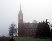
- Parish Church of the Archangel St. Michael in Zblewo, built in 1880.
Web links
Commons : Gmina Zblewo - collection of pictures, videos and audio files
Individual evidence
- ↑ population. Size and Structure by Territorial Division. As of June 30, 2019. Główny Urząd Statystyczny (GUS) (PDF files; 0.99 MiB), accessed December 24, 2019 .
- ↑ Regioset.pl (Polish)
- ↑ The Historical Place Directory.

