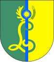
Gmina Lubichowo
| Gmina Lubichowo | ||
|---|---|---|

|
|
|
| Basic data | ||
| State : | Poland | |
| Voivodeship : | Pomerania | |
| Powiat : | Starogardzki | |
| Geographic location : | 53 ° 52 ' N , 18 ° 24' E | |
| Residents : | see Gmina | |
| Postal code : | 83-240 | |
| Telephone code : | (+48) 58 | |
| License plate : | GST | |
| Gmina | ||
| Gminatype: | Rural community | |
| Gmina structure: | 12 school offices | |
| Surface: | 161.01 km² | |
| Residents: | 6636 (Jun. 30, 2019) |
|
| Population density : | 41 inhabitants / km² | |
| Community number ( GUS ): | 2213062 | |
| Administration (as of 2010) | ||
| Community leader : | Sławomir Bieliński | |
| Address: | ul.Zblewska 8 83-240 Lubichowo |
|
| Website : | www.lubichowo.pl | |
The Gmina Lubichowo is a rural community in starogard county of Pomorskie in Poland . Its seat is the village of the same name ( German Lubichow , 1940–1942 Lubichau , 1942–1945 Liebichau , Kashubian Lëbichòwò ) with 2276 inhabitants (2009).
structure
The rural community (gmina wiejska) Lubichowo includes twelve districts (German names, official until 1945) with a Schulzenamt ( sołectwo ) :
- Bietowo ( Bietau )
- Lubichowo (until 1940 Lubichow )
- Mermet ( Mermitten )
- Mościska ( Moschiska )
- Ocypel ( Occipel )
- Osowo Leśne ( Ossau )
- Smolniki
- Szteklin ( Stecklin I )
- Wda
- Wilcze Błota ( Wilscheblott )
- Zelgoszcz ( Zellgosch )
- Zielona Góra ( Green Mountain )
Other localities in the municipality are:
- Budy ( Budda )
- Kaliska
- Krępki ( Krampken )
- Kujawy ( Kujawia )
- Lipinki Królewskie
- Młynki
- Pawelec
- Plony
- Skowronek
- Szteklinek
- Wdecki Młyn
- Ziemianek
traffic
Lubichowo, Ocypel and Zelgoszcz had a train station on the Smętowo – Szlachta railway line .
Community personalities
- Clara Siewert (1862–1945), German painter, born and raised on the Budda estate
- Elisabeth Siewert (1867–1930), German writer, born and raised on Gut Budda.
Individual evidence
- ↑ population. Size and Structure by Territorial Division. As of June 30, 2019. Główny Urząd Statystyczny (GUS) (PDF files; 0.99 MiB), accessed December 24, 2019 .
- ↑ a b Liebichau district on territorial.de by Rolf Jehke. Retrieved September 25, 2016.
- ↑ The Historical Place Directory

