Gurgler Valley
| Gurgler Valley | ||
|---|---|---|
|
Gurgler Tal with Obergurgl from the ascent path to the Ramolhaus |
||
| location | Tyrol , Austria | |
| Waters | Gurgler Ache | |
| Mountains | Ötztal Alps , Stubai Alps | |
| Geographical location | 46 ° 53 ' N , 11 ° 2' E | |
|
|
||
| height | 1470 to 2200 m above sea level A. | |
| length | 15 km | |
The Gurgler Tal (also Gurgltal ) is a source valley of the Ötztal in the Ötztal Alps in Tyrol . The Gurgler Ache flows through it.
geography
The Gurgler Valley branches off at the end of the Ötztal near Zwieselstein ( 1470 m above sea level ) to the south to the main Alpine ridge . With the Venter Tal branching off at the same point, it represents the continuation of the Ötztal. Most of the valley lies in the Ötztal Alps , below the confluence of the Timmelsbach, the Gurgler Ache forms the border to the Stubai Alps to the east .
South of Zwieselstein, the Gurgler valley roughly 150-meter high valley level on. Then the valley floor rises evenly up to a second, smaller step at Pill at around 1780 m. In the middle section around Obergurgl, the valley floor is relatively wide and flat. Above, the valley narrows again and continues to rise to around 2200 m, where the glacier zone begins.
In the west it is separated from the Venter Valley and Niedertal by a ridge that rises from the Mittagskogel ( 2825 m above sea level ) to the south and in the Ramolkogel at an altitude of 3549 m above sea level. A. achieved. The steep slopes have a 6 km long, relatively wide valley shoulder with numerous small lakes at an altitude of 2400 to 2500 m , which is an ideal high pasture .
The eastern side of the valley is less steep and, in contrast to the western side, is interrupted by several side valleys, which mostly flow as hanging valleys over a steep step into the Gurgler valley. Out of the valley these are the Langtal, the Rotmoostal, the Gaisbergtal, the Ferwalltal, the Königstal and the Timmelstal. The latter offers a transition to Passeier via the Timmelsjoch ( 2474 m above sea level ) . A valley shoulder used as an alpine pasture can only be found in short sections at an altitude of 2200 to 2300 m. The Gurgler Kamm as the eastern boundary reaches its highest point in the high wilderness ( 3480 m above sea level ).
The Gurgler Ferner forms the head of the valley in the south . There are also larger glaciers in the eastern side valleys, including the Langtaler Ferner , the Rotmoosferner and the Gaisbergferner . On the western side of the valley, due to the weather and relief, there are only a few smaller glaciers at altitudes above 2800 m.
Development and settlement
In the valley are the settlements of the village of Gurgl (around 500 inhabitants), which are accessible via the Ötztalstrasse and Gurgler Strasse (L 15). In the summer months, the Timmelsjoch High Alpine Road enables a connection to South Tyrol. The last place in the valley is Obergurgl at 1907 m above sea level. A. , the highest church village in Austria. Today the valley is heavily touristy and has an extensive ski area (Obergurgl-Hochgurgl) on the east side.
Natural hazards
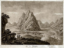
Due to the steep slopes , the Gurgler Valley is often affected by avalanches , some of which led to the destruction of buildings and fatalities. In January 1951, for example, all buildings, including the church in Untergurgl and Angern, were destroyed by avalanches, killing seven residents. In the 18th and 19th centuries the regular eruption of the Gurgler ice lake caused devastation in the entire Gurgler valley.
literature
- Karl Krainer: Geology and geomorphology of Obergurgl and the surrounding area. In: Eva-Maria Koch, Brigitta Verschbamer (eds.): Glacial and periglacial habitats in the Obergurgl area. Alpine Research Center Obergurgl, Volume 1, Innsbruck University Press, Innsbruck 2010, ISBN 978-3-902719-50-8 , pp. 31-52. ( PDF; 1.6 MB )
- Alexander Zanesco: On the archaeological find in Obergurgl . In: Eva-Maria Koch, Brigitta Verschbamer (ed.): At the borders of the forest and human settlement. Alpine Research Center Obergurgl, Volume 2, Innsbruck University Press, Innsbruck 2012, ISBN 978-3-902811-40-0 , pp. 75-98. ( PDF; 2.2 MB )
- cards
- ÖK50 2104 Sölden
- Alpine club card sheet 30/1 Ötztal Alps, Gurgl 1: 25,000, ISBN 3-928777-38-6
Web links
- Gurgler Valley in the Tyrol Atlas of the University of Innsbruck
Individual evidence
- ↑ Entry on Gurgltal in the Austria Forum (in the AEIOU Austria Lexicon )
- ↑ Tirol Atlas: Natural History Tyrol
- ↑ Luis Pirpamer: natural event avalanche: a natural occurrence . In: In: R. Lackner, R. Psenner, M. Walcher (eds.): Is it the Sindt river? Cultural strategies & reflections for the prevention and management of natural hazards. alpine space - man & environment, vol. 4. Innsbruck University Press, Innsbruck 2008, ISBN 978-3-902571-32-8 , pp. 75-84. ( PDF; 2.7 MB )


