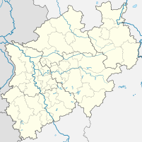
Port of Ibbenbueren
| Port of Ibbenbueren | |||
|---|---|---|---|
| Data | |||
| UN / LOCODE | DE IBB | ||
| operator | Albert Bergschneider GmbH and others | ||
| opening | 1904/1961 | ||
| Port type | Port and lands | ||
| Throughput | 1.03 million tons (2011) | ||
| website | Port of Ibbenbueren | ||
| Geographic information | |||
| place | Ibbenbueren | ||
| country | North Rhine-Westphalia | ||
| Country | Germany | ||
| View of the Uffeln harbors from the north | |||
| Coordinates | 52 ° 18 '40 " N , 7 ° 37' 37" E | ||
|
|||
The ports of Ibbenbüren include three landfall points and two ports in the area of the city of Ibbenbüren in the Westphalian Tecklenburger Land ( Steinfurt district ).
geography
The ports of Ibbenbüren are located in separate locations to the south and northwest of the town center at an altitude of 49.6 to 50.6 m above sea level. NN on the federal waterways Mittelland Canal (MLK) and on the Dortmund-Ems Canal (DEK).
| Location: waters - km |
Port: | description | Quay length | Furnishing |
|---|---|---|---|---|
| MLK 4.9 West | port | Oil port | 85 m, Dalben | Pumps, siding |
| MLK 4.4 East | Lands | Uffeln harbor | 340 m sponged | 2 cranes, scales, siding |
| MLK 3.5 | port | Recreational boating and berths | 370 m sloping | Turning space, water, sewage, electricity |
| DEK 105 East | Lands | L&S GmbH transfer point | 320 m sponged | Mobile crane |
| DEK 99.7 East | Lands | Dörenthe harbor | 500 m sponged | Crane, scales, siding, turning area |
history
The Dortmund-Ems Canal reached Ibbenbüren as early as 1900 . The first land, mainly for the transshipment of building materials, agricultural products and coal, was created in the Dörenthe district from 1904. From 1905, the construction of the Mittelland Canal was pushed eastwards, the volumes handled rose steadily and a rail connection to the port was established in the 1930s.
The port facilities were completely destroyed during the Second World War and gradually rebuilt in the early 1950s. From 1960, the land on the Mittelland Canal was built and built over the labor camps and bunker facilities set up there during the war. A large number of duds that first had to be cleared made the rebuilding difficult. The old passage of the Mittelland Canal (today's branch canal ) was abandoned and the canal was rebuilt further west. From 1964 a rail connection was established to the new port facilities in Uffeln.
Handling volumes
The handling volumes of the Ibbenbüren ports:
| year | Uffels | Dörenthe |
|---|---|---|
| 2012 | 723.070 | 183,360 |
| 2013 | 682.910 | 123.010 |
| 2014 | 851,000 | 141,000 |
| 2015 | 654,000 | 130,000 |
| 2016 | 506,000 | 183,000 |
| 2017 | 506,000 | 211,000 |
Commerce and infrastructure
Today the ports of Ibbenbüren consist of several industrial areas that complement the port facilities with important infrastructure. Pull-out tracks lead directly to the quays of the ports.
In addition to cranes and conveyor belts, there are also special facilities for handling and storing liquids. A tri-modal cargo handling ship / rail / road is also at the landing Ibbenbüren. In 2011 the amount of 1 million tons per year was exceeded for the first time.
traffic
The ports are connected to the European trunk road network with two access options to the federal motorway 30 .
Web links
- Uffeln port railway and transshipment (Youtube video, 36 min.)
Individual evidence
- ↑ The beginnings of shipping in Ibbenbüren after 1900
- ↑ a b Railway connections of the Ibbenbüren ports
- ↑ Forced labor and the Uffeln bunker
- ^ Change of route in the 1960s
- ↑ State Office for Information and Technology North Rhine-Westphalia (IT.NRW) Data on the handling volumes of the ports in North Rhine-Westphalia 2012/13 (pdf)
- ↑ State Office for Information and Technology North Rhine-Westphalia (IT.NRW) data on the handling volumes of the ports in North Rhine-Westphalia 2014/15 (pdf)
- ↑ State Office for Information and Technology North Rhine-Westphalia (IT.NRW) Data on the handling volumes of the ports in North Rhine-Westphalia 2016/17 (pdf)
- ↑ Güterumschlag NRW 2011/12 (.pdf) ( Memento of the original from April 28, 2016 in the Internet Archive ) Info: The archive link was inserted automatically and has not yet been checked. Please check the original and archive link according to the instructions and then remove this notice.


