Port Recke
| Port Recke | |||
|---|---|---|---|
| Data | |||
| UN / LOCODE | DE RCK | ||
| owner | Recke community | ||
| operator | Albert Bergschneider GmbH | ||
| Port type | port | ||
| Geographic information | |||
| place | Warrior | ||
| country | North Rhine-Westphalia | ||
| Country | Germany | ||
| View of Recke harbor from the northeast | |||
| Coordinates | 52 ° 21 '23 " N , 7 ° 43' 7" E | ||
|
|||
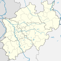
The port of Recke includes a port basin and a marina in the area of the municipality of Recke in the Westphalian Tecklenburger Land ( Steinfurt district ).
geography
The port of Reckes is located south of the town center at an altitude of 50.6 m above sea level. NN at kilometer 13.5 on the federal waterway Mittellandkanal (MLK). To the east it is bounded by the railway bridge, next to which a 170 m long culvert runs. To the west there is a small industrial area and the bridge of Ibbenbürener Strasse and the Mühlenbach crosses under the Mittelland Canal in a 90 m long culvert.
| Location: waters - km |
Port: | description | Quay length | Furnishing |
|---|---|---|---|---|
| MLK 12.8 south | Marina | Recreational boating and berths | 185 m, sloping | Jetties, 60 berths |
| MLK 13.1 | Turning point | up to 70 ship length | ||
| MLK 13.5 north | port | 220 m, sponged | 1 gantry crane , storage areas |
history
From 1905 the construction of the Mittelland Canal was pushed eastwards, and the railway also reached Recke. A tri-modal cargo handling ship / rail / road was possible in Recke, however, there was initially no fixed port facility there.
Commerce and infrastructure
Today the port of Reckes consists of a port basin and a small industrial area, which complements the port facility with important infrastructure. The port is mainly set up for the handling of building materials and coal and is operated by Albert Bergschneider GmbH. There is a 25 m high gantry crane with a load capacity of 8 t, 32,000 m² of storage space for various bulk goods and a 50 t vehicle scale. Two ships up to 110 m in length can moor at the quays , but only one can be handled at a time.
At the nearby Reckes Marina there are also docks for excursion boats and recreational boats . Small vehicles will find suitable jetties and their own supply and disposal facilities there.
traffic
Local roads connect the port to the federal motorway 30 running 11 km south and the federal road 218 17 km north. The Tecklenburger Nordbahn runs immediately to the east , but a pull-out track to the port has not yet been created. Access to public transport is available around 500 m away.
Web links
Individual evidence
- ↑ Location of the port of Recke
- ↑ Infrastructure Port Recke ( Memento of the original from May 6, 2016 in the Internet Archive ) Info: The archive link was automatically inserted and not yet checked. Please check the original and archive link according to the instructions and then remove this notice.
- ↑ Marina Recke


