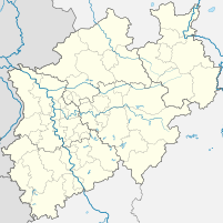
Mettingen land
| Mettingen land | |||
|---|---|---|---|
| Data | |||
| UN / LOCODE | DE MTT | ||
| owner | Mettingen community | ||
| operator | Kasilith | ||
| Port type | Lands | ||
| Goods handled | Out of service | ||
| Geographic information | |||
| place | Mettingen | ||
| country | North Rhine-Westphalia | ||
| Country | Germany | ||
| Land Mettingen (2018) | |||
| Coordinates | 52 ° 21 '47 " N , 7 ° 47' 54" E | ||
|
|||
The Lände Mettingen was a factory harbor in the area of the municipality of Mettingen in the Westphalian Tecklenburger Land ( Steinfurt district ).
geography
The port of Mettingen is five kilometers north of the town center at an altitude of 50.6 m above sea level. NN at kilometer 19 south on the federal waterway Mittellandkanal (MLK) surrounded by dense trees. Neuenkirchener Strasse runs to the west . The Mettinger Moor nature reserve is just north of the canal .
history
The Mittelland Canal has been running through the municipality of Mettingen since 1905 , but initially there was no port of its own there.
Until the mid-2010s, there was an industrial site with its own port facility. There were two portal cranes , outdoor and indoor storage areas, as well as a plugged quay with a length of 90 m. It was last operated commercially by VbF GmbH. In the second half of the 2010s, the onshore transshipment facilities and warehouses were demolished and partly remodeled with a solar park . Only the quay, which today serves as a private mooring, and the waterside turning bay for ships up to 90 m in length have been preserved. The land is fenced off and is no longer freely accessible. Only an unpaved road leads through the site of the solar park to the quay.

