Hardberg (Odenwald)
| Hardberg | ||
|---|---|---|
|
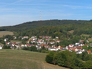
Hardberg from the southwest, Unter-Abtsteinach in the foreground |
||
| height | 593.1 m above sea level NHN | |
| location | at Abtsteinach ; Bergstrasse District , Hesse ( Germany ) | |
| Mountains | Odenwald | |
| Dominance | 18.8 km → Katzenbuckel | |
| Notch height | 178 m ↓ Gras-Ellenbach sawmill | |
| Coordinates | 49 ° 32 '14 " N , 8 ° 48' 19" E | |
| Topo map | LAGIS Hessen | |
|
|
||
| particularities | Hardberg transmitter | |
The Hardberg near Abtsteinach in the Hessian district of Bergstrasse is 593.1 m above sea level. NHN the third highest mountain in the Odenwald .
geography
location
The Hardberg is located in the Bergstrasse-Odenwald Nature Park on the border between the crystalline Vorderen Odenwald in the west and the Buntsandstein-Odenwald in the east. The western slope and the summit are part of the Unter-Abtsteinach district of the Abtsteinach community . The village of Siedelsbrunn in the municipality of Wald-Michelbach is located on the north-eastern slope in a clearing at an altitude of around 505 m . The forest areas to the south above Siedelsbrunn up to the summit region are part of the forest area of the core community of Wald-Michelbach. The ridge of the Hardberg, which is part of the Zentwald forest, extends in a north-south direction for almost 1 km. To the south, in the same forest area, is the Stiefelhöhe ( 584 m ).
Natural allocation
The Hardberg belongs to the natural spatial main unit group Odenwald, Spessart and Südrhön (No. 14) in the main unit Sandsteinodenwald (144; see also Buntsandstein-Odenwald ) and to the subunit Central Hinterer Odenwald (144.6). To the north its landscape falls into the subunit Tromm-Odenwald (145.4) and to the west into the subunit Eichelberg-Odenwald (145.1), both of which belong to the main unit Vorderer Odenwald (145).
Infrastructure

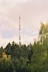
On the northern part of the summit region of the Hardberg stands the 135 m high tower of the Hardberg transmitter, built in 1988, with Hessischer Rundfunk broadcasting systems for VHF and directional radio.
The psychotherapeutic specialist clinic on Hardberg was located on the northern foothills of the Hardberg until October 2008 at an altitude of about 530 m . Since 2010, the building has been used as a Buddhist monastery under the name Buddhas Weg . The Hardberg sports area, which is used by FC Ober-Abtsteinach, is also located on the northern edge of the forest.
Winter sports are possible on the 900 m long Hardberg slope, which is located on the north-eastern mountain slope with a ski lift.
About 1.5 km south-southeast of the Hardberg are the ruins of the pilgrimage and cult of the Virgin Mary in Lichtenklingen .

