Harle (river)
| Harle | ||
|
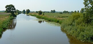
Harle at Wittmund |
||
| Data | ||
| location | Wittmund district , ( Lower Saxony ) | |
| River system | Harle | |
| source | Confluence of Süder Tief , Norder Tief 53 ° 33 ′ 3 ″ N , 7 ° 44 ′ 25 ″ E |
|
| Source height | 1 m above sea level NN | |
| muzzle | at Harlesiel in the North Sea Coordinates: 53 ° 42 ′ 26 " N , 7 ° 48 ′ 31" E 53 ° 42 ′ 26 " N , 7 ° 48 ′ 31" E |
|
| Mouth height | 0 m above sea level NN | |
| Height difference | 1 m | |
| Bottom slope | 0.04 ‰ | |
| length | 23.5 km | |
| Catchment area | 200 km² | |
| Left tributaries | Hattersumer Leide, Blersumer Leide, Burhafer Leide, Buttford Leide, Kasernengraben , Updorfer Leide | |
| Right tributaries | Uthörner Leide, Nöttenser Leide, Dykschloot, Hundshammsleide, Funnix-Berdumer Wasserzug, Funnixer Alte Leide, Altfunnixsieler Tief | |
| Small towns | Wittmund | |
| Communities | Altfunnixsiel , Neufunnixsiel , Carolinensiel , Harlesiel | |
| Residents in the catchment area | 20,000 | |
| Ports | Altfunixsieler Hafen, Carolinsieler Sielhafen, Harlesieler inland port, Harlesieler North Sea port | |
| Navigable | Sport boat: 14 km, cutter: 7 km, paddle steamer “Concordia II”: 3 km, small passenger ships: 1 km | |
The Harle is a small river in the Wittmund district in East Frisia . It lies entirely in the area of the city of Wittmund and flows into the North Sea in the district of Harlesiel through a sluice . In terms of the type of flowing water , it is marshland .
swell
The two spring arms Norder Tief and Süder Tief converge to form the Harle near the Wittmund district of Willen . Both are bodies of water that have their origin in moorland .
Run
The Harle runs east of the Wittmund core city and then flows meandering towards the north. It crosses the Carolinensiel district and flows through a lock and a pumping station into the Harlesieler Hafen and from there into the North Sea. In the Middle Ages, the Harle at Altfunnixsiel flowed into the Harle Bay , which was diked step by step from 1550 onwards.
Continuation in the Wadden Sea
The estuarine priel the Harle is the Caroline Sieler Balje. It is one of the southern arms of the Harle lake , which separates the North Sea islands of Spiekeroog and Wangerooge .
Protection status
The Harle lies to below Neufunnixsiel in the FFH area "Teichfledermaus- Habitate im Raum Wilhelmshaven" and in the landscape protection area " Teichfledermausgewässer ".
tourism
In terms of tourism, the Harle is important as a paddling area and in the ports of Carolinensiel and Harlesiel it is also important for boat and ferry traffic . Harlesiel is the ferry point to the island of Wangerooge .
Web links
- Description of the Harle (PDF, 117 kB)
Individual evidence
- ↑ a b Description of the Harle and its tributaries (PDF, 117 kB)
