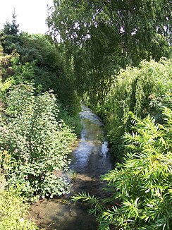
Harste (leash)
| Harste | ||
| Data | ||
| location | District of Göttingen and Northeim , Lower Saxony , Germany | |
| River system | Weser | |
| Drain over | Leine → Aller → Weser → North Sea | |
| source | in peas 51 ° 34 ′ 55 ″ N , 9 ° 48 ′ 18 ″ E |
|
| muzzle | east of Parensen in the Leine Coordinates: 51 ° 36 ′ 53 " N , 9 ° 54 ′ 57" E 51 ° 36 ′ 53 " N , 9 ° 54 ′ 57" E
|
|
| length | approx. 8.6 km | |
| Catchment area | 55.6 km² | |
The Harste is a left tributary of the Leine in the districts of Göttingen and Northeim in southern Lower Saxony .
The approximately 8.6 km long stream has its source in Peas , a village belonging to the Adelebsen area, and then flows in a north-easterly direction through Harste , a village belonging to the Bovenden area , and through Parensen , a district of the Nörten-Hardenberg area . The Harste then crosses under the A 7 and the L 555 and flows into the Leine immediately afterwards. The catchment area of the Harste stretches from Gladeberg and Hevensen in the north to Ossenberg and just before Barterode in the southwest.
Web links
- Parensen on the Harste (photo)
- http://www.natur-erleben.niedersachsen.de/karte/thema-landkreis-2603.html
Individual evidence
- ↑ a b c Overview of surface water bodies for the implementation of the EC WFD. (No longer available online.) In: Interactive environmental maps of the environmental administration. Lower Saxony State Agency for Water Management, Coastal Protection and Nature Conservation, archived from the original on February 18, 2012 ; Retrieved July 29, 2011 . Info: The archive link was inserted automatically and has not yet been checked. Please check the original and archive link according to the instructions and then remove this notice.
